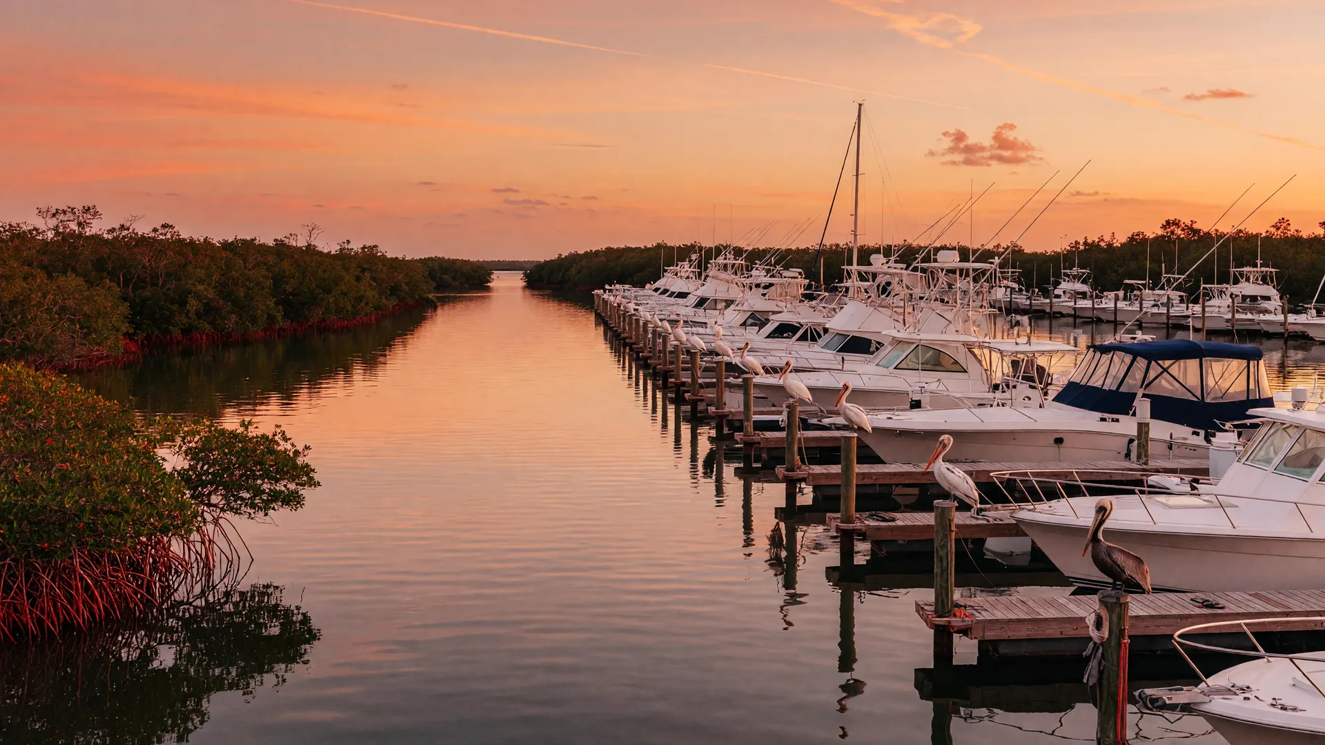
Boating
Boating & Waterway Guide
The Gulf Coast is a paradise for boaters: miles of protected Intracoastal Waterway, world-class fishing, marinas with fuel, and waterfront restaurants reachable only by water. This guide is organized like a trip: quick reference first, then passes, ramps, docks, launches, marinas, fuel, dining, tides, rentals, fishing and charters.
New to the water? The Boating, Fishing, and Life on the Water primer covers launching, seasons, and what the waterfront lifestyle costs.
Venice · Boating
Venice Boating & Waterway Guide
Venice boating runs on the Intracoastal Waterway and the Gulf, with public ramps and full-service marinas close together and the regularly dredged, marked Venice Inlet as the Gulf gateway. Midnight Pass to the north is a wild, unstabilized pass, never a routine transit. This guide covers ramps, docks, launches, marinas, fuel, dining by boat, tides, rentals, fishing and charters, Venice first.
Safety alert · Venice Inlet jetties
Humphris Park and the South Jetty walkway are closed
The City of Venice reports that Humphris Park and the South Jetty walkway at Venice Inlet remain closed due to severe damage from Hurricanes Helene and Milton. Conditions are unsafe and visitors should not go there; there is no reopening date. The U.S. Army Corps of Engineers owns the jetties, and major repairs are still years away, with a maintenance report expected in November 2026.
The North Jetty on the Nokomis side remains open, and the Venice Inlet channel itself stays an active, federally maintained navigation inlet. The closure applies to the jetty walkway and the park, not to the channel.
Venice · Boating
Boating in Venice
Venice boating runs on the Intracoastal Waterway and the Gulf, with public ramps and full-service marinas a short distance apart. Venice information comes first below, then nearby Nokomis and Casey Key, then regional options. Midnight Pass, north of Casey Key, is a wild pass with no markers or jetties, never a routine transit.
In Venice: Humphris Park and the South Jetty walkway at Venice Inlet are closed for storm repairs; the channel itself remains open. The North Jetty at Nokomis stays open. See the safety alert above.
In Venice
Verified public concrete boat ramp at 301 E Venice Ave on the east side of the Intracoastal Waterway next to the bridge, with restrooms, picnic shelters and benches, maintained by Sarasota County.
County park pagePublic small-boat ramp at 1330 Tarpon Center Dr on the Intracoastal, reopened to the public after 2024 storm repairs.
City facility pageMyakka River canoe and kayak launch at 4076 E Venice Ave, a calm river alternative for paddlers.
County parks pageRegularly dredged, marked channel just north of Venice. Stay inside the marked channel and keep clear of the jetties and sandbars; the south jetty walkway and Humphris Park remain closed, see the safety alert above.
Pass & tide hubCaution: reopened by the 2024 hurricanes after being closed since 1983, but Sarasota County and county engineers describe it as a wild pass, not a navigable pass. No permanent jetties or Coast Guard markers and shifting sand; never a routine transit.
Midnight Pass guideRestricted: community ramp at 4800 Lemon Bay Dr run by the South Venice Beach Endowment Trust, with access by smartphone app and smart locks, no overnight parking and membership required. Not an open public launch.
Trust boat ramp pageNearby · Nokomis & Casey Key
Sarasota County ramp on Blackburn Bay at Nokomis Beach, 100 Casey Key Rd, open 24 hours, popular with fishing boats.
Motorized ramp on the bay side of Nokomis at 800 Loreto Court.
Waterfront dining on the Intracoastal at 801 Blackburn Point Rd, Osprey, near Casey Key.
Regional
For the full regional picture, keep scrolling: the complete ramp, dock, launch, marina, fuel and charter listings below cover the whole Gulf Coast, from Sarasota Bay to the south county waterways.
Jump to all boat rampsBoater's Quick Reference
Boater's Quick Reference
Stable reference information and cautions that do not change with the daily tide, plus the official live-data links. Pass identities and hazards read as a reference; depths, channels and bars change with tides, weather, dredging and shoaling, so always confirm with current NOAA charts and live data before you go. Each pass name jumps directly to that pass's own section on the Tide & Pass dashboard.
Pass Notes & Cautions
Regularly dredged, marked channel just north of Venice in Sarasota County. Stay inside the marked channel and keep clear of the jetties and sandbars. Check current NOAA charts (US Harbors carries the NOAA chart for Venice Inlet) and NOAA station VENF1 for live conditions.
Between south Lido Key and north Siesta Key. Deep and wide inside, but the outer bar is unmarked, shoaling and constantly moving; navigation aids have been removed in whole or part. High-caution, local-knowledge pass, not a recommended transit for unfamiliar boaters.
Between Siesta Key and Casey Key, reopened by the 2024 hurricanes after being closed since 1983. Sarasota County and county engineers describe it as a wild pass, not a navigable pass: no permanent jetties or Coast Guard markers and shifting sand. Not a routine transit.
Lido Key pass beside Mote Marine. Channel markers have been removed and conditions shift with tides and storms. Local knowledge and current charts required; no transit window is published here.
Stabilized inlet between Longboat Key and Anna Maria Island. Drawbridge opens on request; confirm current depths and conditions with NOAA before transiting.
South toward Naples. Both are natural passes that shoal at the inlet mouth; conditions change with tides and storms, so check current charts and live NOAA data before crossing.
Live Tide, Weather & Radar
NOAA Tides & Currents Portal
Official federal tide data. Search any station for 7-day predictions and water levels.
NOAA Marine Forecast
Official marine weather for Gulf waters: wind, seas and offshore conditions by zone.
NWS Tampa Bay Radar
Live radar loop, watches, warnings and marine statements.
US Harbors: Venice Inlet NOAA Chart
Free current NOAA nautical chart for Venice Inlet, with the marked channel and live tide reference.
NOAA VENF1: Venice Marine Data
NOAA real-time marine weather station VENF1 at Venice, for live conditions near Venice Inlet.
Pre-Departure Checklist
- Check live tide data for your pass and compare it with the pass notes in the Quick Reference above
- Check the NOAA marine forecast and match wind and sea state to your vessel and crew
- Check current NOAA charts, Local Notice to Mariners and any pass-specific cautions before the trip
- Check fuel, safety gear and VHF radio
- File a float plan with someone on shore
Passes & Inlets
Passes & Inlets
Every pass has its own personality. Each name below is a link straight to that pass's full section (depth, best conditions, hazards and live NOAA buttons) on the Tide & Pass Resource Hub.
Venice Inlet
Regularly dredged, marked channel just north of Venice in Sarasota County. Stay inside the marked channel and keep clear of the jetties and sandbars. Check current NOAA charts (US Harbors carries the NOAA chart for Venice Inlet) and NOAA station VENF1 for live conditions.
Open pass sectionBig Sarasota Pass
Between south Lido Key and north Siesta Key. Deep and wide inside, but the outer bar is unmarked, shoaling and constantly moving; navigation aids have been removed in whole or part. High-caution, local-knowledge pass, not a recommended transit for unfamiliar boaters.
Open pass sectionMidnight Pass
Between Siesta Key and Casey Key, reopened by the 2024 hurricanes after being closed since 1983. Sarasota County and county engineers describe it as a wild pass, not a navigable pass: no permanent jetties or Coast Guard markers and shifting sand. Not a routine transit.
Open pass sectionNew Pass
Lido Key pass beside Mote Marine. Channel markers have been removed and conditions shift with tides and storms. Local knowledge and current charts required; no transit window is published here.
Open pass sectionLongboat Pass
Stabilized inlet between Longboat Key and Anna Maria Island. Drawbridge opens on request; confirm current depths and conditions with NOAA before transiting.
Open pass sectionBig Carlos Pass & Gordon Pass
South toward Naples. Both are natural passes that shoal at the inlet mouth; conditions change with tides and storms, so check current charts and live NOAA data before crossing.
Open pass sectionBoating near you
Boating Near You
Every community's own boating content first, then nearby, then regional. Arrive from a community hub and that community's card moves to the top and is marked. All facilities below come from the verified lists in this guide.
Sarasota
You're exploringSarasota boats Sarasota Bay and the Intracoastal, with bayfront ramps and marinas and Gulf passes at its barrier keys.
In Sarasota
Boat ramp
Boat ramp
Boat ramp
Public dock
Public dock
Kayak & paddle launch
Kayak & paddle launch
Kayak & paddle launch
Kayak & paddle launch
Kayak & paddle launch
Marina
Marina
Marina
Fishing charter
Fishing charter
Boat tour
Boat tour
Boat tour
Sunset cruise
Nearby
Boat ramp
Nearby · Public ramp
Nearby · Public ramp
Nearby · Freshwater ramp
Venice
You're exploringVenice boats the Intracoastal and the Gulf through the regularly dredged, marked Venice Inlet, with public ramps and full-service marinas close together.
In Venice
Boat ramp
Boat ramp
Boat ramp
Boat ramp
Boat ramp
Kayak & paddle launch
Kayak & paddle launch
Full-service marina
Fishing charter
Fishing charter
Fishing charter
Nearby
Boat ramp
Boat ramp
Boat ramp
Kayak & paddle launch
Osprey
You're exploringOsprey centers on Little Sarasota Bay: county ramps and kayak launches at Blackburn Point and a marina at the swing bridge.
In Osprey
Boat ramp
Kayak & paddle launch
Nearby
Boat ramp
Boat ramp
Boat ramp
Boat ramp
Nokomis
You're exploringNokomis launches into Blackburn Bay and Dona Bay, with Midnight Pass and Venice Inlet as the Gulf options to the north and south.
In Nokomis
Boat ramp
Boat ramp
Kayak & paddle launch
Kayak & paddle launch
Nearby
Boat ramp
Boat ramp
Boat ramp
Boat ramp
Bradenton
You're exploringBradenton boats the Manatee River and the Gulf beaches west, with county ramps and full-service marinas along the river.
In Bradenton
Nearby · Public ramp
Nearby · Freshwater ramp
Public boat ramp
Public dock
Nearby
Boat ramp
Boat ramp
Boat ramp
Nearby · Public ramp
Anna Maria Island
You're exploringAnna Maria Island launches from county and city ramps on the bayside, minutes from Longboat Pass and Tampa Bay.
In Anna Maria Island
Public boat ramp
Public boat ramp
Nearby
Nearby · Public ramp
Nearby · Public ramp
Nearby · Freshwater ramp
Public dock
Lakewood Ranch
You're exploringLakewood Ranch has no beaches or marinas within its community boundaries: it sits between Sarasota and Bradenton, so boating means trailering to verified nearby launches at the Braden River ramp (State Route 64) in Bradenton, Lake Manatee State Park to the east, and Bayfront Park on Longboat Key.
No dedicated boating facilities in this guide are verified for Lakewood Ranch yet; the nearest options are listed below.
Nearby
Nearby · Public ramp
Nearby · Public ramp
Nearby · Freshwater ramp
Siesta Key
You're exploringSiesta Key boats Little Sarasota Bay and the Gulf passes at its ends; ramps sit at Turtle Beach and the marina at the Stickney Point Bridge.
In Siesta Key
Nearby
Boat ramp
Boat ramp
Boat ramp
Public dock
North Port
You're exploringNorth Port boats the Myakka River system from the city ramp at Marina Park; there are no marinas in city limits, so trailering is the norm.
In North Port
Public boat ramp
Nearby
Boat ramp
Boat ramp
Boat ramp
Boat ramp
Englewood
You're exploringEnglewood lives on Lemon Bay, a protected aquatic preserve with county ramps and low bridges; most day boats stay bay-side and trailer-launch.
In Englewood
Public boat ramp
Public boat ramp & paddlecraft launch
Public boat ramp
Nearby
Boat ramp
Boat ramp
Boat ramp
Boat ramp
Port Charlotte
You're exploringPort Charlotte's canal system connects to Charlotte Harbor, with county ramps at Port Charlotte Beach, El Jobean, Spring Lake and South Gulf Cove.
In Port Charlotte
Public boat ramp & kayak launch
Public boat ramp
Public boat ramp
Full-service marina
Private marina with fuel dock
Nearby
Public boat ramp
Public boat access
Public boat ramp
Public boat ramp & paddlecraft launch
Punta Gorda
You're exploringPunta Gorda boats Charlotte Harbor from the city marina and ramps and the Fishermen's Village dockage downtown.
In Punta Gorda
Public boat ramp
Public boat access
Public municipal marina, no fuel
Private commercial marina with fuel & guest dockage
Private marina with fuel & dock-and-dine
Dock & dine restaurant
Nearby
Public boat ramp
Public boat ramp
Public boat ramp & city marina
Public boat ramp
Cape Coral
You're exploringCape Coral's canal system connects to the Caloosahatchee River and the Gulf, with five improved city ramps plus marina villages at Cape Harbour and Tarpon Point.
In Cape Coral
Public boat ramp
Public boat ramp
Public boat ramp & city marina
Public boat ramp
Freshwater public boat ramp
Closed · redevelopment pending
Full-service marina
Full-service marina with fuel & pump-out
Full-service marina
Dock & dine restaurant
Dock & dine restaurant
Nearby
Public boat ramp
Public boat ramp
Public boat ramp
Public boat access
Fort Myers
You're exploringFort Myers boats the Caloosahatchee: Lee County ramps at Davis Blvd and Punta Rassa, a municipal basin closed since 2022 awaiting the Suntex rebuild, and Fort Myers Beach marinas clearly labeled to the west.
In Fort Myers
Public boat ramp
Public boat ramp
Closed · redevelopment planned
Public-slip marina & dock-and-dine
Full-service marina with fuel & transient slips
Dock & dine restaurant
Dock & dine restaurant
Nearby
Public boat ramp
Public boat ramp
Public boat ramp & city marina
Public boat ramp
St. Petersburg
You're exploringSt. Petersburg boats Tampa Bay and Boca Ciega Bay from city ramps and a downtown municipal marina, with Gulf access through the passes at the barrier beaches; Gulfport is a separate city listed Nearby.
In St. Petersburg
Public boat ramp
Public boat ramp
Public boat ramp
Public boat ramp
Municipal marina
Full-service marina
Full-service marina
Nearby
Municipal marina (Gulfport)
Wellen Park
You're exploringWellen Park's Grand Lake is paddle-only (kayak and paddleboard rentals, no motorized ramp); the closest public ramps and marinas sit about 10 to 15 minutes west in Venice.
No dedicated boating facilities in this guide are verified for Wellen Park yet; the nearest options are listed below.
Nearby
Boat ramp
Boat ramp
Boat ramp
Boat ramp
Boat Ramps
Public Boat Ramps
Verified public launch sites from Sarasota County south through Port Charlotte and Punta Gorda, across Cape Coral and Fort Myers on the Caloosahatchee, and over Tampa Bay in St. Petersburg, with the street address shown on the page so you never have to leave it to find a ramp. Directions open in Google Maps.
Centennial Park
Public boat ramp1059 N Tamiami Trail, Sarasota FL 34236
Three double-lane ramps into Sarasota Bay with trailer parking, beside Bayfront Park downtown.
Ken Thompson Park
Public boat ramp1700 Ken Thompson Pkwy, Sarasota FL 34236
Lido Key park with boat access near New Pass and Mote Marine.
Turtle Beach Park
Public boat ramp8918 Midnight Pass Rd, Sarasota FL 34242
Siesta Key launch with motorized and non-motorized ramps.
Blackburn Point Park
Public boat ramp800 & 421 Blackburn Point Rd, Osprey FL 34229
Little Sarasota Bay / Intracoastal access in Osprey. Kayak-friendly.
Nokomis Beach Public Boat Ramp
Public boat ramp100 Casey Key Rd, Nokomis FL 34275
Sarasota County ramp on Blackburn Bay at Nokomis Beach: motorized and non-motorized ramps plus a canoe and kayak launch, open 24 hours, courtesy docks and trailer parking.
Loreto Court Bay Access
Public boat ramp800 Loreto Court, Nokomis FL 34275
Motorized ramp on the bay side of Nokomis.
Higel Marine Park
Public boat ramp1330 Tarpon Center Dr, Venice FL 34285
City of Venice small-boat ramp on the Intracoastal, reopened after 2024 storm repairs.
Marina Park and Boat Ramp
Public boat ramp301 E Venice Ave, Venice FL 34285
Verified public concrete boat ramp on the east side of the Intracoastal Waterway next to the bridge, with restrooms, picnic shelters and benches, maintained by Sarasota County.
South Venice Community Boat Ramp
Restricted Access4800 Lemon Bay Dr, Venice FL 34293
Restricted: community ramp run by the South Venice Beach Endowment Trust with access by smartphone app and smart locks, no overnight parking, membership required. Not an open public launch.
Snook Haven
Public boat ramp4076 E Venice Ave, Venice FL 34292
Myakka River boat ramp and canoe/kayak launch at Snook Haven Park, Sarasota County.
Shamrock Park & Nature Center
Public boat ramp3900 Shamrock Dr, Venice FL 34293
County water-access park; primarily a canoe and kayak launch on the Intracoastal.
Marina Park (North Port)
Public boat ramp7030 Chancellor Blvd, North Port FL 34287
Double-lane ramp to the Myakka River via Myakkahatchee Creek.
Burnt Store (New Burnt Store) Boat Ramp
Public boat ramp230 Burnt Store Rd S, Cape Coral FL 33991
City of Cape Coral improved ramp facility on 4.5 acres with boat-trailer parking: access to Matlacha Pass, the Caloosahatchee and the Gulf. One of the city’s five improved ramps, accessible 24/7 unless closed for safety or repairs.
Horton Park Boat Ramp
Public boat ramp2600 SE 26th Pl, Cape Coral FL
City of Cape Coral improved ramp on the Caloosahatchee with park amenities; accessible 24/7 unless closed for safety or repairs.
Rosen Park Boat Ramp & Marina
Public boat ramp & city marina2414 SE 15th Terrace, Cape Coral FL
City of Cape Coral improved ramp and marina on the Caloosahatchee; accessible 24/7 unless closed for safety or repairs.
Crystal Lake Park Boat Ramp
Public boat ramp4307 NW 36th St, Cape Coral FL
City of Cape Coral improved ramp at the 2025-opened Crystal Lake Park with boat-trailer parking; one of the city’s five improved ramps, accessible 24/7 unless closed for safety or repairs.
BMX (Lake) Boat Ramp
Freshwater public boat ramp1509 SW 7th Court, Cape Coral FL 33991
City of Cape Coral freshwater access ramp beside the Strausser BMX Sports Complex, launching into the Shelburne Canal; accessible 24/7 unless closed for safety or repairs.
Cape Coral Yacht Club Community Park Boat Ramp
Closed · redevelopment pending5815 Driftwood Pkwy, Cape Coral FL
CLOSED: the city boat ramp and marina at Yacht Club Community Park remain closed while the multi-phase park redevelopment proceeds. The marine-phase construction contract was approved in November 2025 and work is underway, with no public reopening date yet.
Davis Boat Ramp
Public boat ramp2227 Davis Blvd, Fort Myers Shores FL 33905
Lee County single-lane community ramp on the Caloosahatchee River, open dawn to dusk: paid parking $5/day, no overnight mooring.
Punta Rassa Boat Ramp
Public boat ramp15001 Punta Rassa Rd, Fort Myers FL 33908
Lee County public ramp near San Carlos Bay with access to open Gulf waters. Storm-damaged by Hurricane Ian, the ramp reopened in 2026 with improvement work continuing and partial closures possible; check Lee County for current ramp status.
Demens Landing Park Boat Ramp
Public boat rampBayshore Dr & 2nd Ave S, St. Petersburg FL 33701
Downtown St. Pete public ramp beside the marina basin, open 24 hours: free paved ramp with docks and limited trailer parking.
Grandview Park Boat Ramp
Public boat ramp6th St S & 39th Ave S, St. Petersburg FL 33705
St. Pete public ramp with two concrete lanes into Tampa Bay, open 24 hours: free, paved and ADA accessible.
Maximo Park Boat Ramp
Public boat ramp34th St S & Pinellas Point Dr S, St. Petersburg FL 33711
St. Pete public ramp into Boca Ciega Bay with several paved lanes, docks and ample parking; the park also has trails, a boardwalk and a beach.
Jungle Prada de Narvaez Park Boat Ramp
Public boat ramp8322 Elbow Ln N, St. Petersburg FL 33710
St. Pete public ramp launching into Boca Ciega Bay, open 24 hours: free paved single-lane ramp with docks and about 60 parking spaces.
Ponce de Leon Park Boat Ramp
Public boat ramp3400 Ponce de Leon Pkwy, Punta Gorda FL 33950
City of Punta Gorda ramp with dedicated trailer parking: gateway to the Punta Gorda Isles canal system and Charlotte Harbor. Daytime use with park amenities.
Gilchrist Park Boat Access
Public boat access1000 W Retta Esplanade, Punta Gorda FL 33950
Waterfront park on Charlotte Harbor with a fishing pier and boating access; the ramp status can change, so verify with the city before trailering in.
El Jobean Boat Ramp
Public boat ramp & kayak launch4224 El Jobean Rd, Port Charlotte FL 33953
Charlotte County public boat ramp and kayak launch into the Myakka River / Alligator Bay with a single launch lane, courtesy docks, a paved launch, parking and restrooms. Public access, no fuel on site. No transient policy is published, so none is claimed.
Port Charlotte Beach Park Boat Ramp
Public boat ramp4500 Harbor Blvd, Port Charlotte FL 33952
Charlotte County public boat ramp with 2 launch lanes, a paved ramp, docks, parking and restrooms, handicap accessible; a launch fee applies. No fuel on site. No restaurant is documented as boat-accessible here.
Spring Lake Park Boat Ramp
Public boat ramp3520 Lake View Blvd, Port Charlotte FL 33948
Charlotte County ramp on the park lake system, reopened in November 2024 after hurricane repairs; the park’s canoe and kayak launch remains closed. County pay-to-park applies.
Braden River Boat Ramp (State Route 64)
Nearby · Public rampBraden River Boat Ramp, 3020 Manatee Ave E, Bradenton FL 34208
NEARBY (Bradenton): Manatee County public ramp on the Braden River with a paved lane, trailer parking, a courtesy dock and a fish-cleaning table; quick runs into the Manatee River. No overnight parking per county ordinance.
Bayfront Park Boat Ramp (Longboat Key)
Nearby · Public rampBayfront Park Addition, 4052 Gulf of Mexico Dr, Longboat Key FL 34228
NEARBY (Longboat Key, for northern Sarasota and Lakewood Ranch): Sarasota County ramp at Bayfront Park Addition with direct access to Sarasota Bay; open daily, park hours apply. Phone (941) 316-1999.
Lake Manatee State Park Boat Ramp
Nearby · Freshwater rampLake Manatee State Park, 20007 State Road 64 E, Bradenton FL 34212
NEARBY (East Bradenton): freshwater double-lane ramp with floating docks on Lake Manatee and a 20-horsepower motor limit. State park entrance fee applies ($5 per vehicle for 2 to 8 people, $4 single occupant); open 8 AM to sundown.
63rd Street Memorial Park Boat Ramp
Public boat ramp63rd St and Marina Way, Holmes Beach, Anna Maria Island FL 34217
Manatee County public boat ramp with a single launch lane and 9 trailer parking spaces.
Coquina South Boat Ramp
Public boat rampSouthern end of Anna Maria Island at Coquina Beach, Bradenton Beach FL
Manatee County public boat ramp that reopened in November 2024 after hurricane repairs.
Ainger Creek Park Boat Ramp
Public boat ramp2011 Placida Rd, Englewood FL 34224
Free public ramp on Lemon Bay with roughly 24 vehicle-and-trailer spaces.
Indian Mound Park Boat Ramp
Public boat ramp & paddlecraft launchIndian Mound Park, Englewood FL
Free public boat ramp and paddlecraft launch on Lemon Bay.
Manasota Beach Park Boat Ramp
Public boat rampManasota Beach Park, Englewood FL
Free public ramp on Lemon Bay with 2 launch lanes and about 49 parking spaces.
Public Docks
Public Docks & Tie-Ups
Where to tie up to visit downtown: paid transient dockage and free day docks. Where a dock doubles as a kayak or paddle access point, that is noted.
Marina Jack Yacht Basin (transient dockage)
2 Marina Plaza, Sarasota FL 34236
Main downtown transient marina: slips to about 228 ft, in-slip pump-out, dinghy dock and ship store. Transient daily rates apply; book ahead.
Centennial Park Day Docks (The Bay)
10th St at Centennial Park boat basin, Sarasota FL
18 free public day slips on the south side of the Centennial Park boat basin so boaters can visit downtown. Free, time-limited (about 6 hours). Also a kayak and paddle tie-up point for Bayfront paddlers.
Bradenton Riverwalk Pier
Downtown Bradenton, Manatee River (between Green and DeSoto bridges)
Public day dock on the Manatee River: free day tie-up, typically 6 AM to 11 PM, steps from the Riverwalk.
Kayak & Paddle
Kayak & Paddle Launch Points
Verified launch points for kayaks and paddleboards across Sarasota County, each with name, description, address, directions, official information and known restrictions or fees where confirmed. Anything unconfirmed is marked, never guessed.
South Lido Park Mangrove Trail / Ted Sperling Nature Park
190 Taft Dr, Sarasota FL 34236 (park entrance 2201 Benjamin Franklin Dr)
The classic Lido Key mangrove tunnel paddle. Ted Sperling Nature Park holds the launch; tour outfitters operate from here.
Free public access; no launch fee confirmed
Bird Key Park (Lido Trail launch)
200 John Ringling Causeway, Sarasota FL 34236
Protected bay-side launch on the Lido Key paddling trail.
Free public access; no launch fee confirmed
Siesta Key Beach Access #1 (Lido Trail launch)
3940 N Shell Rd, Sarasota FL
Paddle launch near the north end of Siesta Key for the Lido Trail system.
Free public access; fees unconfirmed
Myakka River Outpost (Myakka River State Park)
13208 State Road 72, Sarasota FL 34241
Concessions inside Myakka River State Park renting canoes and kayaks, with ramps on Upper Myakka Lake and launches at picnic areas along the drive. Phone (941) 923-1120.
State park entrance fee applies; rentals and launch details confirm with the park
Shamrock Park & Nature Center
3900 Shamrock Dr, Venice FL 34293
County water-access park with a canoe and kayak launch on the Intracoastal.
Free public access; no launch fee confirmed
Snook Haven Park
4076 E Venice Ave, Venice FL 34292
Myakka River paddling access at the historic Snook Haven park.
Public park; fees unconfirmed
Overlook Park
101 Gulf of Mexico Dr, Longboat Key FL 34228
Bay-side paddle launch on Longboat Key, on the county Blueways network.
Free public access; no launch fee confirmed
Blackburn Point Park
800 Blackburn Point Rd, Osprey FL 34229
Little Sarasota Bay launch shared with the motorized ramp; popular for mangrove tunnels to the south.
Free public access; no launch fee confirmed
Loreto Court Bay Access
800 Loreto Court, Nokomis FL 34275
Bay-side ramp and paddling access in Nokomis.
Free public access; no launch fee confirmed
Myakka State Forest
2555 S River Rd, Sarasota FL
Paddle trail launches along the Myakka River and Myakkahatchee Creek system.
Fees unconfirmed
Bay Point Park
490 Lyons Bay Rd, Nokomis FL 34275
Paddle access on Lyons Bay. Pedestrian access only, no trailer ramp.
Pedestrian access only
Marinas
Marinas
Verified municipal marinas, full-service marinas and day-boat dockage from Sarasota and Venice south to Punta Gorda, Cape Coral and Fort Myers, and across Tampa Bay in St. Petersburg. Private clubs are not listed here; see the Sailing Clubs block in the charters section.
Marina Jack Yacht Basin
Marina2 Marina Plaza, Sarasota FL 34236
Full-service downtown marina: transient and annual slips, fuel dock, pump-out, ship store and restaurants. Vessels to about 228 ft.
Safe Harbor Siesta Key
Marina1265 Old Stickney Point Rd, Sarasota FL 34242
Full-service marina with fuel dock (gas and diesel) on Little Sarasota Bay.
Hidden Harbor Marina
Marina7700 S Tamiami Trail, Sarasota FL 34231
South Sarasota marina with a fuel dock on the Intracoastal.
Fuel dock confirmed via Go Boating Florida; hours unconfirmed
Crow's Nest Marina & Restaurant
Full-service marina1968 Tarpon Center Dr, Venice FL 34285
Venice marina on the Intracoastal (GIWW Mile Marker 58) with fuel (gas/diesel), slips and the waterfront restaurant.
Safe Harbor Cape Harbour
Full-service marina5828 Cape Harbour Dr, Cape Coral FL
Full-service marina at the heart of the Cape Harbour dining and shopping village on the Caloosahatchee canal system: transient slips, fuel and event programming.
Tarpon Point Marina
Full-service marina with fuel & pump-outSilver King Blvd, Cape Coral FL 33914
Full-service marina off the Intracoastal Waterway at ICW marker 92 in a protected deep-water basin with about 8 to 12 feet of depth, 261 total slips and vessels up to 75 feet. Fuel dock with gas and diesel, pump-out available. Waterside dining at the Marina Village: Gather, Marker 92 Waterfront Bar & Bistro and Next Door at Tarpon Point; call the marina ahead for dining dockage availability.
Everest Marina
Full-service marina1838 Everest Pkwy, Cape Coral FL
Full-service marina with slips and dry storage near the Horton Park ramp on the Caloosahatchee.
Fort Myers Yacht Basin
Closed · redevelopment planned1300 Lee St, Fort Myers FL
CLOSED: the city-run 241-slip municipal marina in the downtown River District on the Caloosahatchee between the Caloosahatchee and Edison bridges has been closed since Hurricane Ian (2022) and is not yet rebuilt. The planned Suntex Marinas redevelopment is still in permitting (extended to 2027), so no slips are currently available; subject to change.
The Marina at Edison Ford
Public-slip marina & dock-and-dine2360 W First St, Fort Myers FL 33901
Public-slip marina on the Caloosahatchee at the Edison and Ford Winter Estates with 45 public slips, upgraded composite docks, pump-out services, 30/50 amp electric, showers and restrooms, free WiFi and ample parking. No fuel dock is verified, so none is claimed. On-site waterfront restaurant Pinchers (Pinchers Crab Shack) is on the marina property, so boaters tie up at the public slips and walk to the restaurant, a verified dock-and-dine with public slips.
Gulf Harbour Marina
Full-service marina with fuel & transient slips14490 Vista River Dr, Fort Myers FL 33908
Private full-service deep-water marina on the Caloosahatchee at ICW marker 73 with 186 slips accommodating vessels up to 97 feet, floating concrete docks, a full-service fuel dock with gasoline and diesel (Rec 90 / ValvTect diesel), transient slips available (reserve ahead; 11 transient slips per directory listing), pump-out at the slips, 30/50 amp power, potable water, air-conditioned bathhouses and laundry. Pump-out is available; call ahead to confirm transient availability. No restaurant boat access is documented at this marina, so none is claimed.
Salty Sam's Marina
Marina (Fort Myers Beach)2500 Main St, Fort Myers Beach FL 33931
FORT MYERS BEACH, not local to Fort Myers city: bay-side marina on Estero Island about 25 minutes from downtown Fort Myers. Verify hours and services with the marina before you go.
Fish-Tale Marina
Marina (Fort Myers Beach)7225 Estero Blvd, Fort Myers Beach FL 33931
FORT MYERS BEACH, not local to Fort Myers city: marina on Estero Island about 25 minutes from downtown Fort Myers. Verify hours and services with the marina before you go.
St. Petersburg Municipal Marina
Municipal marina500 1st Ave SE, St. Petersburg FL 33701
City marina on the downtown waterfront beside the St. Pete Pier: transient dockage, pump-out and amenities. Open and operating while a full redevelopment is planned, with construction anticipated to begin 2028 and completion around 2031; transient arrivals check in with the marina ship store, and availability is subject to change.
Maximo Marina
Full-service marina4801 37th St S, St. Petersburg FL 33711
Full-service marina on Boca Ciega Bay with covered and uncovered wet slips, high-and-dry rack storage, a repair department and a fuel dock (fuel hours about 8 AM to 4:30 PM). Phone (727) 867-1102.
Harborage Marina at Bayboro
Full-service marina1110 3rd St S, St. Petersburg FL 33701
Deepwater full-service marina on sheltered Bayboro Harbor near downtown with Gulf access, a fuel dock, high-and-dry storage and transient slips. Phone (727) 821-6347.
Gulfport Municipal Marina
Municipal marina (Gulfport)4630 29th Ave S, Gulfport FL
GULFPORT, a separate city from St. Petersburg: municipal marina open and operating with fuel and a ship store; the South Basin is being rebuilt after 2024 storm damage while the marina stays in operation. Phone (727) 893-1071.
Laishley Park Municipal Marina
Public municipal marina, no fuel120 Laishley Court, Punta Gorda FL 33950
City of Punta Gorda operated public municipal marina on Charlotte Harbor and the Peace River, with transient dockage, a fishing pier, bait shop, public boat launch, day room and boater showers. No fuel at this marina (public facility, no fuel dock). Dock-and-dine at the adjacent Laishley Crab House, 150 Laishley Court, Punta Gorda FL 33950, which sits along Laishley Marina and Charlotte Harbor.
Fishermen's Village Marina
Private commercial marina with fuel & guest dockage1200 W Retta Esplanade, Punta Gorda FL 33950
Private commercial marina on Charlotte Harbor with about 97 slips and transient day dockage, bookable via Dockwa (call ahead to confirm availability). Fuel dock with ethanol-free gas and diesel, open roughly 7 a.m. to 5 p.m. (call ahead to confirm). A private commercial marina with a fuel dock and guest dockage, within walking distance of its own waterfront dining: Harpoon Harry’s and Village Brewhouse at Fishermen’s Village.
Safe Harbor Burnt Store Marina
Private marina with fuel & dock-and-dine3192 Matecumbe Key Rd, Punta Gorda FL 33955
Private, service-rich marina on the east shore of Charlotte Harbor, roughly midway between Punta Gorda and the harbor entrance at Boca Grande, inside a gated residential community. Verified features: reservable transient slips, gasoline and diesel fuel, pump-out, shore power, fresh water hookups, floating and fixed wooden slips, and a ship’s store. Waterfront restaurant at the marina: Cass Cay Restaurant, open 7 days a week from 10 a.m. to 10 p.m., offering deck seating, bar, sports bar and live music. Boaters tie up at the transient slips and walk to Cass Cay, a verified fuel dock plus dock-and-dine facility. It is a private marina; transient slips are reservable ahead. No phone is verified, so none is listed.
El Jobean Marina
Full-service marina4170 El Jobean Rd, Port Charlotte FL
Full-service marina on the Myakka River at El Jobean with dry storage, service and repair.
Gulf Coast Marine Center
Private marina with fuel dock4240 El Jobean Rd, Port Charlotte FL 33953
Private marina on the Myakka River offering a fuel dock, listed in Charlotte Harbor boating fuel guides as a fuel source on the water. It is the verified fuel marina for the Port Charlotte side. No restaurant dockage and no transient policy are verified, and no phone is verified, so none is claimed.
Fuel
Fuel Locations
Verified gas and diesel docks from Sarasota and Venice south to Punta Gorda and Cape Coral. Fuel availability is stated only where confirmed; hours we could not verify are marked unconfirmed.
Marina Jack Yacht Basin Fuel Dock
Gas / Diesel2 Marina Plaza, Sarasota FL 34236
Available: Gasoline (ValvTect 90-octane) and diesel
Hours: 24 hours with credit card; staffed about 8 AM-5 PM
Safe Harbor Siesta Key Fuel Dock
Gas / Diesel1265 Old Stickney Point Rd, Sarasota FL 34242
Available: Gasoline and diesel
Hours: Hours unconfirmed
Hidden Harbor Marina Fuel Dock
Gas / Diesel7700 S Tamiami Trail, Sarasota FL 34231
Available: Gas fuel dock (per Go Boating Florida)
Hours: Hours unconfirmed
Crow's Nest Marina Fuel Dock
Gas / Diesel1968 Tarpon Center Dr, Venice FL 34285
Available: Gas and diesel
Hours: Hours unconfirmed
Fishermen's Village Marina Fuel Dock
Gas / Diesel1200 W Retta Esplanade, Punta Gorda FL 33950
Available: Ethanol-free gas and diesel
Hours: Roughly 7 a.m. to 5 p.m.; call ahead to confirm
Tarpon Point Marina Fuel Dock
Gas / Diesel6179 Black Marlin Ln, Cape Coral FL 33914
Available: Gas and diesel
Hours: Hours unconfirmed
Gulf Harbour Marina Fuel Dock
Gas / Diesel14490 Vista River Dr, Fort Myers FL 33908
Available: Gasoline and diesel (Rec 90 / ValvTect diesel)
Hours: Hours unconfirmed
Gulf Coast Marine Center Fuel Dock
Gas / Diesel4240 El Jobean Rd, Port Charlotte FL 33953
Available: Verified fuel dock (per Charlotte Harbor boating fuel guides)
Hours: Hours unconfirmed
Safe Harbor Burnt Store Marina Fuel Dock
Gas / Diesel3192 Matecumbe Key Rd, Punta Gorda FL 33955
Available: Gasoline and diesel
Hours: Hours unconfirmed
Dine by Boat
Dine by Boat
Waterfront restaurants, bars and tiki spots reachable by water, with address, website, directions and dock or tie-up information where verified. Dock capacity is never invented; where we could not confirm it, that is stated.
For the full boat-up dining reference, with dockage notes and call-ahead advice, see the dedicated Dine by Boat guide.
Marina Jack
2 Marina Plaza, Sarasota FL 34236
Dockside dining room and lounges over Sarasota Bay, with transient slips right at the marina.
Transient slips available; book ahead
O'Leary's Tiki Bar & Grill
5 Bayfront Dr, Sarasota FL 34236
Bayfront tiki deck over Sarasota Bay with live music nightly.
Dock access near Island Park; capacity unconfirmed
Casey Key Fish House & Tiki Bar
801 Blackburn Point Rd, Osprey FL 34229
Waterfront fish house on the Intracoastal beside the historic Blackburn Point Swing Bridge.
Dock access available; capacity unconfirmed
Crow's Nest Restaurant, Tavern & Marina
1968 Tarpon Center Dr, Venice FL 34285
Waterfront landmark at the Venice Inlet jetty since 1976, with marina slips at the restaurant.
Marina slips at the restaurant; capacity unconfirmed
Dockside Waterfront Grill
509 N Tamiami Trail, Venice FL 34285
Casual waterfront grill at Fisherman's Wharf Marina (Marker 4) near the Intracoastal.
Marina dock access; capacity unconfirmed
Nokomo's Sunset Hut
690 S Tamiami Trail, Nokomis FL 34275
Directly on Dona Bay, reachable by car and boat with its own dock.
Own dock on Dona Bay; capacity unconfirmed
The Old Salty Dog
1601 Ken Thompson Pkwy, Sarasota FL 34236
Casual pub fare on City Island with waterfront views of the bay.
Boat parking/dock access: unconfirmed, confirm before arriving by boat
Harpoon Harry's
1200 W Retta Esplanade, Punta Gorda FL 33950
Open-air, boat-casual seafood restaurant at the end of Fishermen’s Village on Charlotte Harbor. Phone and hours unverified.
Dock-and-dine at Fishermen’s Village Marina; transient day dockage bookable via Dockwa, call ahead
Village Brewhouse
1200 W Retta Esplanade, Punta Gorda FL 33950
At Fishermen’s Village, right on the water with live music. Phone and hours unverified.
Dock-and-dine at Fishermen’s Village Marina; call ahead
Laishley Crab House
150 Laishley Court, Punta Gorda FL 33950
Waterside restaurant along Laishley Marina and Charlotte Harbor, at the public municipal marina. Phone unverified.
Public transient dockage at Laishley Park Municipal Marina; no fuel at this marina
Gather
5971 Silver King Blvd, Suite 116, Cape Coral FL 33914
Waterside breakfast, lunch and dinner at Tarpon Point Marina. Phone (239) 673-9939.
Boaters tie up at Tarpon Point Marina; call the marina ahead for dining dockage availability
Marker 92 Waterfront Bar & Bistro
5951 Silver King Blvd, Cape Coral FL 33914
Waterside American and seafood inside The Westin Cape Coral Resort at Marina Village. Phone (239) 541-5942.
Boaters tie up at Tarpon Point Marina; call the marina ahead for dining dockage availability
Next Door at Tarpon Point
Tarpon Point Marina, Cape Coral FL
Waterside breakfast, lunch and dinner at Tarpon Point. Phone unverified.
Boaters tie up at Tarpon Point Marina; call the marina ahead for dining dockage availability
Fathoms Restaurant & Bar
5785 Cape Harbour Dr, Suite 106, Cape Coral FL 33914
At Cape Harbour Marina. Dockage is offered for boaters and is complimentary while dining, first come, first served. Phone (239) 542-0123; for dockage availability and reservations, contact the Safe Harbour Marina Master at (239) 945-4330.
Complimentary while dining, first come, first served; contact the Safe Harbour Marina Master
Rumrunners
Cape Harbour Marina, Cape Coral FL
Upscale seafood and steak with waterside seating at Cape Harbour. Street address and phone unverified; for dockage, contact the Safe Harbour Marina Master at (239) 945-4330.
Contact the Safe Harbour Marina Master at (239) 945-4330
Three Fishermen Seafood Restaurant
13021 North Cleveland Avenue, North Fort Myers FL 33903
Waterfront seafood restaurant on the Caloosahatchee just north of the downtown Fort Myers bridge. The restaurant’s own website states waterfront dining with free dockage, so this is a verified dock-and-dine with free guest dockage while dining, and the clearest verified North Fort Myers boat-up restaurant.
Free guest dockage while dining, per the restaurant’s own website
Pinchers Crab Shack (The Marina at Edison Ford)
2360 W First St, Fort Myers FL 33901
Waterfront restaurant on the marina property at The Marina at Edison Ford on the Caloosahatchee. Boaters tie up at the public slips and walk to the restaurant. No fuel dock is verified at this marina.
Public slips at The Marina at Edison Ford; verified dock-and-dine with public slips
Cass Cay Restaurant
3192 Matecumbe Key Rd, Punta Gorda FL 33955
Waterfront restaurant at Safe Harbor Burnt Store Marina on the east shore of Charlotte Harbor, roughly midway between Punta Gorda and the harbor entrance at Boca Grande. Open 7 days a week from 10 a.m. to 10 p.m. with deck seating, bar, sports bar and live music. Boaters tie up at the marina’s reservable transient slips and walk to Cass Cay. Verified fuel dock plus dock-and-dine at a private marina.
Transient slips reservable ahead at Safe Harbor Burnt Store Marina; no phone verified
Sandbars
Sandbars & Shoals
Sandbars are the Gulf Coast's best anchor-up social spots and its most dangerous shallow-water traps. They are also why pass depth readings change: bars shift after every storm, so the depth on a chart can be wrong by the time you arrive.
Venice Inlet Channel
Regularly dredged and marked, but sandbars shift at the inlet mouth outside the jetties. Stay inside the marked channel and keep clear of the jetties and sandbars; check current NOAA charts and NOAA station VENF1 before you go.
Pass details & live dataBig Sarasota Pass Bar
The outer bar is unmarked, shoaling and constantly moving, and navigation aids have been removed in whole or part. Effectively local-knowledge-only: high caution, not a recommended transit for unfamiliar boaters. Check current charts, Local Notice to Mariners and live NOAA data before approaching.
High-caution pass detailsMidnight Pass Bar
Reopened by the 2024 hurricanes after being closed since 1983, but Sarasota County and county engineers describe it as a wild pass, not a navigable pass: no jetties, no Coast Guard markers and shifting sand, monitored by multiple agencies. Not a routine transit.
Wild pass guideRespect the bar
When in doubt, wait for a local guide vessel or ask at a nearby marina. Bars and channels change after every storm, so the depth on a chart can be wrong by the time you arrive.
Tides
Tides Change Daily. Check Live Data.
Tide times, heights and currents vary by day, season and weather. This page does not show tide times that go stale; click through to NOAA for real-time predictions.
Tides Change Daily
Click any link below for real-time NOAA tide predictions. The reference information on this page (pass identities, cautions and fishing patterns) is stable year to year; depths, channels and bars change with tides, storms, dredging and shoaling, so confirm them against current NOAA charts and live data before you go.
NOAA Tides & Currents Portal
Official federal tide data. Search any station for 7-day predictions, water levels and currents for every Gulf Coast pass.
Open Live DataNOAA Marine Forecast
Official marine weather forecast for Gulf of Mexico waters: wind, seas and offshore conditions by zone.
Open Marine ForecastNWS Tampa Bay Radar
Live radar loop, watches, warnings and marine statements for the region.
Open NWS RadarFull Inlet & Tide Dashboard
Pass-by-pass navigation notes, live NOAA tide tables, 7-day tide predictions, moon phase effects and the complete Go / No-Go boating checklist. Click anywhere on this card to open it.
Open Full DashboardRentals
Boat & Paddle Rentals
Verified rental and tour operators for kayaks, paddleboards and guided boat trips. Powerboat rental operators in the Sarasota area are not yet verified, so only confirmed businesses appear here.
Clear Kayak Tours (Get Up and Go Kayaking)
Lido Key, Sarasota
Guided clear kayak tours through mangroves with glass-bottom views.
Siesta Key Watersports
Siesta Key
Kayak and paddleboard rentals plus guided paddles.
Happy Paddler Tours
Venice & Lido Key
Eco-tours through mangroves and seagrass beds; glass-bottom clear kayaks.
Ride and Paddle
South Venice
Kayak rentals and guided paddling tours with equipment and instruction.
Fun Boat Tours
Siesta Key Marina
Private boat tours and eco-tours from Siesta Key Marina.
Fishing
Fishing
The full fishing resource: licenses, seasons, slot and bag limits, species library, piers, charters, tides and ramps.
Open Fishing Guide550-foot pier into Sarasota Bay at Causeway Park; no individual license needed to fish from a pier.
Snook, tarpon, grouper and snapper runs near the inlet and the Venice artificial reefs.
Charters
Fishing Charters, Boat Tours & Sunset Cruises
Verified operators only, each with its official website, phone where confirmed, and service area. Book directly with each operator.
Fishing Charters
Sarasota Offshore Fishing Charters
Sarasota (Charter Boat Row)
Offshore grouper, snapper and mahi trips; half-day and full-day.
Outriggers Sport Fishing
Sarasota
Family-friendly inshore and offshore trips for all experience levels.
Bad Habit Offshore Charters
Venice
Venice-based offshore charters to the famous Venice artificial reefs.
Venice Reef Charters
Venice
Offshore fishing expeditions to the Venice reefs and Gulf waters.
Boat Tours
Fun Boat Tours
Siesta Key Marina
Eco-tours, dolphin runs and island hops from Siesta Key Marina.
Pineapple Boat Tours
Sarasota Bay
Private and group tours exploring Sarasota Bay, mangrove islands and wildlife.
Sarasota Bay Explorers
Mote Marine, Sarasota
Marine-science guided boat tours of Sarasota Bay with Mote Marine.
Sunset Cruises
LeBarge Tropical Cruises
2 Marina Plaza, Sarasota
Classic sunset sailing cruises on Sarasota Bay with live narration (daily 5:30 PM & 7:30 PM).
Sailing Clubs & Organizations
Sarasota Sailing Squadron
1717 Ken Thompson Pkwy, Sarasota
Florida Sailing & Powerboat School
2001 Whitfield Park Ave, Sarasota
Dreaming of Waterfront Living?
Find Your Slip
Many Gulf Coast homes come with boat docks or community marina access. Let Michael help you find a waterfront property that matches your boating lifestyle.
Message Received
Thank you for reaching out. We will be in touch within 24 hours.
Something went wrong. Please try again or call us directly at 240-357-3279.
Waterway News
Boating conditions, fishing reports and waterfront dining updates delivered weekly.