Siesta Key · Sarasota County
Midnight Pass
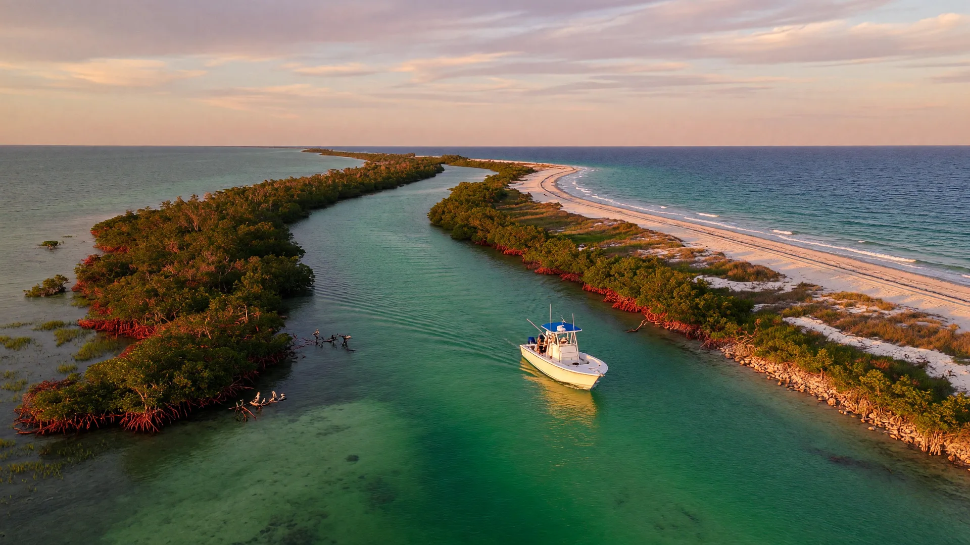
Midnight Pass is the historic pass at the southern end of Siesta Key, connecting the Gulf of Mexico to Little Sarasota Bay in Sarasota County. Closed for four decades and naturally reopened by the 2024 hurricanes, it is once again an open, unmarked inlet between Siesta Key and Casey Key. Sarasota County and county engineers describe it as a wild pass, not a navigable pass: no permanent jetties, no Coast Guard markers and shifting sand. It is not a routine transit.
A Pass That Came Back
Midnight Pass sits at the south end of Siesta Key, where the Gulf of Mexico meets Little Sarasota Bay. The pass was filled in 1983, and for about 40 years boats and tides moved through only as a faint memory. Hurricane Helene and Hurricane Milton in 2024 blew it back open, and it has remained open since.
Today it is a wild, unstabilized inlet: no jetties, no permanent Coast Guard buoys, and no dredged channel. Sarasota County and county engineers describe it as a wild pass, not a navigable pass, and multiple agencies monitor it. The water literally changes with every storm. This guide keeps the stable facts, points you to live NOAA tide data, and marks everything we could not confirm as unconfirmed.
Quick Facts
- Location: South end of Siesta Key, Sarasota County, FL
- Connects: Gulf of Mexico to Little Sarasota Bay
- History: Closed by filling in 1983, reopened by 2024 hurricanes
- Markers: No jetties, no permanent navigational buoys
On the Water
Boating at Midnight Pass
Sarasota County and county engineers describe Midnight Pass as a wild pass, not a navigable pass: no permanent jetties, no Coast Guard markers and no dredged channel, with sand that shifts constantly. Do not treat it as a routine or recommended transit, and do not plan a trip around crossing it. Conditions change with every storm and tide, and multiple agencies monitor the pass.
Navigation Notes
- Unstabilized, unmarked, and shallower-free: no jetties, no buoys, no dredged channel
- Depths shift with every storm; do not trust last month, or last week, channel shapes
- Currents and depths change with every storm and tide; there is no reliable charted channel to follow
- Local boaters watch the water: darker water reads deeper, sandy flashes mean shallow
- Manatee slow-speed and no-wake rules apply on the bay side around the pass
Unconfirmed: the exact channel location, depth, and marker status change quickly and cannot be verified here. Check local reports and current NOAA chart updates before transiting.
Nearby Water & Ramps
The pass fronts Little Sarasota Bay, with Siesta Key on one shore and Casey Key on the other. Closest public launches for the south-key area:
- Turtle Beach Park · 8918 Midnight Pass Rd, Siesta Key · motorized and non-motorized ramps
- Blackburn Point Park · Osprey · Little Sarasota Bay access, kayak-friendly
Paddle
Kayaking & Paddleboarding
For paddlers, Little Sarasota Bay side of the pass is the friendlier water: calm flats, seagrass, mangrove banks and dolphin-watching without fighting the Gulf swell. The pass itself is a tidal chute, treat it with respect and always paddle on a rising tide you can see.
- Paddle the bay side from Turtle Beach or Blackburn Point for mangrove tunnels and flat water
- Check the tide before launching: an ebbing pass can sweep a paddleboard sideways fast
- Sharks, rays and manatees visit the channels; give them space and know your wildlife etiquette
- Sun protection, reef-safe sunscreen and a life jacket are non-negotiables on the Gulf side
Fishing
Fishing the Pass
The pass area is a classic Gulf Coast fishing spot: clean Gulf water pours over a natural bar on the in going tide, mullet and pilchards gather there, and the predators follow. Snook, Spanish mackerel, trout and other inshore species all work these mixed waters when the tide is moving.
Species, seasons, slot and bag limits, and best areas are all covered in the full guide. License rules apply to saltwater fishing from boats and shore in Florida.
Tides & Live Data
Tide Information
No tide station sits in Midnight Pass itself. Tide information for the area uses the nearby Sarasota tide station data: NOAA's Sarasota station (8726083) gives the closest reference predictions for the Little Sarasota Bay side. The pass's currents and depths are its own and change with every storm, so treat any nearby station reading as reference only, not as a transit guide.
Tide predictions are forecasts, not guarantees. Wind, weather and barometric pressure shift actual water levels; always verify conditions on the water and note the pass's channel moves.
Weather
Check the Forecast
Gulf weather turns in minutes. Check the marine forecast, the radar and the tide before you commit to the pass: a squall in the afternoon is normal in summer, and lightning clears the water immediately.
Sarasota Weather & ForecastDirections
Getting There
Midnight Pass sits at the south end of Siesta Key, reachable by car along Midnight Pass Road. From downtown Sarasota take US-41 south, cross the Stickney Point Bridge, then follow Midnight Pass Road to its end near Turtle Beach. For a shoreline view, walk the beach at the south end of Siesta Key or drive onto Casey Key to look north across the pass.