01 · Out and About
Biking, Walking & Trails
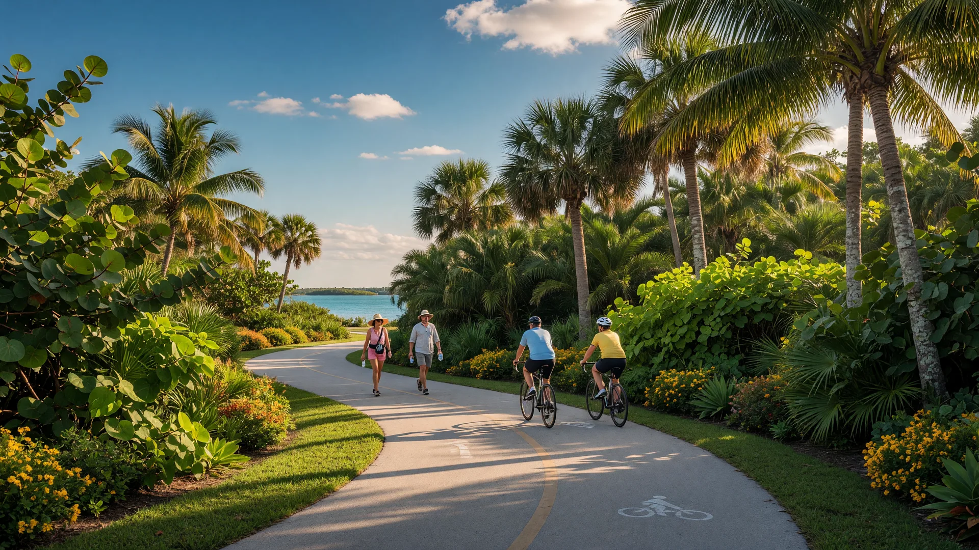
Sarasota-area biking, walking and trails for residents and visitors: the Legacy Trail between Sarasota and Venice, its trailheads, the Venetian Waterway Park Trail, and the regional connections that keep growing this network. The Sarasota walking and biking trails are paved, mostly flat, and open to everyone.
01 · Out and About · Venice
Biking, Walking & Trails in Venice
Venice may be at its best on two feet or two wheels: the Venetian Waterway Park's concrete path runs along both sides of the Intracoastal between Caspersen Beach and Shamrock Park, and the Legacy Trail starts right at the Historic Venice Train Depot. Roughly 9.3 miles of waterfront trail plus an 18.5-mile rail trail, both dog friendly and open to everyone.
01 · Out and About · Osprey
Biking, Walking & Trails in Osprey
The Legacy Trail runs straight through Osprey, and Oscar Scherer State Park sits right in town. Start at the Osprey Junction Trailhead or the state park, where the paved rail-trail and the park's nature trails meet.
01 · Out and About · Nokomis
Biking, Walking & Trails in Nokomis
Nokomis's trail scene is the Legacy Trail corridor: the county trailheads at Nokomis Community Park and Nokomis Riverview Park put you on the paved rail-trail in minutes. The Venetian Waterway Park starts just south in Venice.
01 · Out and About · Bradenton
Biking, Walking & Trails in Bradenton
Bradenton rides the water: the 1.5-mile Riverwalk along the Manatee River, the multiuse trail network across Robinson Preserve's 682 acres, and the shaded coastal paths and boardwalks at Emerson Point on Snead Island.
01 · Out and About · Anna Maria Island
Biking, Walking & Trails on Anna Maria Island
Anna Maria Island has no single off-road bike trail. Its cycling network is a mix of on-road bike lanes along Gulf Drive, a short paved path along Coquina Beach, and a shared-use path across the Manatee Avenue causeway from the mainland.
01 · Out and About · Lakewood Ranch
Biking, Walking & Trails in Lakewood Ranch
Lakewood Ranch keeps its riding close to home: James L. Patton Park has trails for a short family trip, and the community's wide, well-kept roads are a popular road-cycling ground. The Legacy Trail is a drive west into Sarasota County.
01 · Out and About · Siesta Key
Biking, Walking & Trails on Siesta Key
Siesta Key has no dedicated off-road bike trail network. Cycling here means on-road bike lanes on Midnight Pass Road and Ocean Boulevard, beach riding on the hard-packed sand, and the closest paved rail-trail a short drive over the bridges on the mainland.
01 · Out and About · North Port
Biking, Walking & Trails in North Port
North Port reaches the Legacy Trail through its own paved connector, and keeps greenway-style trails through its creek preserves plus the walking paths at Warm Mineral Springs. It is a modest but real riding scene.
01 · Out and About · Wellen Park
Biking, Walking & Trails in Wellen Park
Wellen Park is built for walking and cycling, with miles of paved pathways linking Downtown Wellen, its lakefront loop and neighborhood parks. The North Port Connector carries riders from the community's edge to the Legacy Trail.
01 · Out and About · Englewood
Biking, Walking & Trails in Englewood
Englewood's trails are natural and walk-first: Lemon Bay Park and Environmental Center offers 210 acres of shoreline walking paths, and beach walking on Manasota Key starts at the public beach access points. The nearest paved rail-trail rides sit just outside town.
01 · Out and About · Port Charlotte
Biking, Walking & Trails in Port Charlotte
Port Charlotte's riding starts on the harbor at Bayshore Live Oak Park, whose paved waterside paths survived storm repairs in phases. The bigger trail systems sit nearby in Punta Gorda and along the Cape Haze Peninsula, clearly labeled below.
01 · Out and About · Punta Gorda
Biking, Walking & Trails in Punta Gorda
Punta Gorda is Charlotte County's walking and cycling town: roughly 18 miles of Pathways connect the neighborhoods, the 2.5-mile Harborwalk runs the waterfront from Trabue Park to Fishermen's Village, and the old railroad bed becomes the Linear Park path.
01 · Out and About · Cape Coral
Biking, Walking & Trails in Cape Coral
Cape Coral is a designated Bicycle Friendly Community with more than 90 miles of interconnected bike routes, more than 120 miles of bike lanes and paths, seven signed routes and a 49-mile circular perimeter route. Park greenways add the walking side.
01 · Out and About · Fort Myers
Biking, Walking & Trails in Fort Myers
Fort Myers rides along its canals: the 6-mile John Yarbrough Linear Park Trail follows the Ten Mile Canal, the North Colonial Linear Park adds another paved corridor, and Six Mile Cypress Slough protects its boardwalk for foot traffic while keeping a bike path on the parkway.
01 · Out and About · St. Petersburg
Biking, Walking & Trails in St. Petersburg
St. Petersburg is the southern anchor of the Fred Marquis Pinellas Trail, the region's most popular paved multi-use path, with the Gulfport spur branching off near mile marker 5 and Fort De Soto Park's island loop at the county's southern tip.
Trail Access Labels
Every trail card below carries a label so you know before you go which trails are open to bikes and which are walk-only. Labels are verified from the managing agency; when a trail has a rule change or closure posted, the card says so in Hours & Fees.
On This Page
01 · Trail Centerpiece
The Legacy Trail
The Legacy Trail is a paved, mostly flat rail-trail running from the Historic Venice Train Depot in Venice north to Fruitville Road and Payne Park in Sarasota along a former railroad corridor, roughly 18.5 miles end to end. The North Extension opened in March 2022 and carries the trail into downtown Sarasota at Payne Park. It's open year-round about 6 a.m. to sunset, it's dog friendly, its surface is nearly flat, and its asphalt suits walkers, runners, cyclists, and families of all ages.
- Free parking at the trailheads.
- Rest stops with benches and displays roughly every mile.
- Mostly flat and fully paved, which makes it one of the most accessible Sarasota walking trails.
- Overpasses at Bee Ridge Road and Clark Road are planned but not yet built.
About the regional connections. The North Port Connector (about 5.5 miles, opened in September 2022) and the Venetian Waterway Park Trail (roughly 9.3 miles) are separate trail systems that tie into the Legacy Trail network. Think of them as connections that extend the network toward North Port and along Venice's Intracoastal Waterway, rather than as part of the Legacy Trail itself.
02 · Where to Start
Legacy Trail Trailheads
Trailheads run north to south from downtown Sarasota to Venice. Parking is free at all of these trailheads. Amenities vary by trailhead, so never assume every facility is at every stop: check the county's trailhead pages for the current details before you plan around a restroom or water fountain. At the northern end the trail reaches Fruitville Road just west of Payne Park, and Payne Park is the served access point with parking.
Payne Park Trailhead
Downtown Start2010 Adams Lane, Sarasota
The downtown Sarasota start of the trail at Payne Park, with a tennis center, skate park, children's playground, amphitheater and cafe. The trail's northern end reaches Fruitville Road here, making the park a natural spot for a short family walk or roll before a longer ride.
Sarasota Springs Trailhead
Sarasota4012 Webber Street, Sarasota
A mid-trail trailhead in the Webber Road area with parking, restrooms, and drinking water. An easy, convenient entry point for a 3 to 5 mile outing.
Ashton Trailhead
Sarasota4301 Ashton Road, Sarasota
A neighborhood trailhead on the south side of Sarasota with parking. Facilities vary here, so check the county page before you go.
Culverhouse Nature Park
Sarasota7301 McIntosh Road, Sarasota
A nature park trailhead south of town where the trail slides into a greener stretch. Parking available; check the county page for current facilities.
Osprey Junction Trailhead
Osprey939 E. Bay Street, Osprey
Reopened after its 2023 improvements with a new restroom, picnic shelters, paved and unpaved parking, and paved park paths. A favorite mid-trail launch point.
Laurel Park
Laurel509 Collins Road, Laurel
A quiet Laurel trailhead with parking. Amenities vary here, so confirm what's open on the county page before you plan a stop.
Nokomis Community Park
Nokomis234 Nippino Trail E, Nokomis
A community park trailhead in Nokomis with parking. Facilities vary, so check the county page for restroom and amenity details.
Nokomis Riverview Park
Nokomis251 Riverview Drive S, Nokomis
A Legacy Trail trailhead on the Dona Bay side of Nokomis with parking. Facilities vary here, so check the county page before you go.
Oscar Scherer State Park
Nokomis / Osprey1843 S. Tamiami Trail, Osprey
The state park the trail passes through, open 8 a.m. to sunset with a $5 per vehicle entry fee; phone 941-483-5956. Also the gateway to the park's own nature trails, where the Lake Osprey loop is an accessible walking trail and the South Creek Nature Trail is foot traffic only.
Patriots Park
Venice800 Venetia Bay Boulevard, Venice
A Venice-side trailhead with parking. Facilities vary here, so confirm current amenities on the county page.
Historic Venice Train Depot & Legacy Park
Southern Terminus395 E. Venice Avenue, Venice
The southern terminus of the Legacy Trail. Parking sits at Legacy Park beside the restored depot, and the depot also connects to the Venetian Waterway Park Trail. Restrooms and a picnic pavilion are nearby, which makes it a natural ride-and-lunch ending point.
03 · Best For
Best For & Suggested Experiences
The Legacy Trail is best for walking, casual biking, longer rides, families, dog walking, and accessible recreation. The paved, mostly flat surface keeps it easy for all ages and abilities.
- Easy 3 to 5 mile outing from a mid-trail trailhead like Osprey Junction or Sarasota Springs.
- Morning ride near Payne Park, where the downtown start meets the trail.
- Full Sarasota-to-Venice ride, roughly 18.5 miles one way. Plan water, snacks, and shade for a day-long outing.
- Walk and lunch at the Historic Venice Train Depot and Legacy Park end of the trail, or near Osprey.
- Family-friendly section with a playground at Payne Park for a short, easy loop.
04 · Venice
Venetian Waterway Park Trail
The Venetian Waterway Park is a linear park with a multi-use concrete trail running along both sides of the Intracoastal Waterway in Venice. The trail is roughly 9.3 miles total, connecting Caspersen Beach in the south to Shamrock Park and Nature Center in the north, and no motor vehicles are allowed on it. Benches, picnic shelters, grills, dog clean-up stations, and restrooms sit at various points along the way, and it's good for walking, biking, dog walking, and birding.
Verified trailheads with parking: the Historic Venice Train Depot (Legacy Park), Marina Park and Boat Ramp, Airport Avenue, behind Venice Theatre, and Shamrock Park and Nature Center. Cross between the two sides at the Circus Bridge or the Venice Avenue Bridge. The Waterway Park connects directly to the Legacy Trail at the Historic Venice Train Depot.
The city directory and county tourism materials list different street addresses for the park, so this guide lists verified trailheads instead.
05 · Nearby Trails & Parks
More Places to Ride
- Oscar Scherer State Park, Nokomis/Osprey. The Legacy Trail passes through the park. Beyond the rail-trail, the park itself offers nature trails, wildlife viewing, restrooms, and picnic areas. Open 8 a.m. to sunset with a $5 per vehicle entry fee; the Lake Osprey Trail is a short accessible walking loop and the South Creek Nature Trail is foot traffic only, while the Legacy Trail and the park's multi-use trails carry the bikes.
- Payne Park, Sarasota. The downtown city park at the Legacy Trail's northern end, with tennis courts, a skate park, a children's playground, an amphitheater, a cafe, and paved paths.
- North Port Connector. About 5.5 miles of paved connector that opened in September 2022, linking North Port's Price Boulevard trailhead to the Legacy Trail through Deer Prairie Creek Preserve. It's a connection that extends the network toward North Port, not part of the Legacy Trail proper.
On This Page · Venice Trails
01 · Local Trails in Venice
The Venetian Waterway Park
Venice's signature ride is the Venetian Waterway Park: a linear park with a multi-use concrete trail running along both sides of the Intracoastal Waterway. Roughly 9.3 miles total, it connects Caspersen Beach in the south to Shamrock Park and Nature Center in the north, and no motor vehicles are allowed on it.
- Verified trailheads with parking: the Historic Venice Train Depot (Legacy Park), Marina Park and Boat Ramp, Airport Avenue, behind Venice Theatre, and Shamrock Park and Nature Center.
- Cross between the two sides at the Circus Bridge or the Venice Avenue Bridge.
- Connects directly to the Legacy Trail at the Historic Venice Train Depot.
Venetian Waterway Park Trail
Both sides of the Intracoastal Waterway, Venice FL (trailheads listed above)
Paved concrete multi-use trail, roughly 9.3 miles total, from Caspersen Beach to Shamrock Park and Nature Center. Dog friendly, good for walking, biking and birding.
- Access
- Historic Venice Train Depot, Marina Park and Boat Ramp, Airport Avenue, behind Venice Theatre, Shamrock Park and Nature Center.
- Parking
- Parking available at all five verified trailheads.
- Hours & Fees
- Open daily; check the City of Venice park page for current access conditions.
02 · The Venice Rail Trail
The Legacy Trail from Venice
The Legacy Trail is an 18.5-mile paved multi-use rail trail running from the Historic Venice Train Depot (Legacy Park, 395 E. Venice Avenue) north to Fruitville Road and Payne Park in Sarasota. It is open year round roughly 6 a.m. to sunset, dog friendly, nearly flat, and parking at the trailheads is free.
The Legacy Trail (Venice Start)
Historic Venice Train Depot, 395 E. Venice Avenue, Venice FL
Paved rail trail from Venice north to Sarasota, roughly 18.5 miles, nearly flat and open to walkers, runners, cyclists and families. Connects to the Venetian Waterway Park Trail at the train depot.
- Access
- Southern terminus at the Historic Venice Train Depot (Legacy Park); 11 verified trailheads between Venice and Sarasota.
- Parking
- Free parking at all trailheads, including Legacy Park.
- Hours & Fees
- Open year round, roughly 6 a.m. to sunset.
Verified Trailheads & Parking
- Legacy Park, 395 E Venice Avenue, Venice
- Patriots Park, 800 Venetia Bay Boulevard, Venice
- Nokomis Community Park, 234 Nippino Trail E, Nokomis
- Nokomis Riverview Park, 251 Riverview Drive S, Nokomis
- Laurel Park, 509 Collins Road, Laurel
- Oscar Scherer State Park, 1843 S Tamiami Trail, Osprey (park entry fee)
- Osprey Junction Trailhead, 939 E Bay Street, Osprey
- Culverhouse Nature Park, 7301 McIntosh Road, Sarasota
- Ashton Trailhead, 4301 Ashton Road, Sarasota
- Sarasota Springs Trailhead, 4012 Webber Street, Sarasota
- Payne Park Trailhead, 2010 Adams Lane, Sarasota
Overpasses at Bee Ridge Road and Clark Road are planned but not yet built.
03 · Venice-Side Trailheads
Where to Start in Venice
Two trailheads sit inside Venice proper with free parking; the full verified list runs north through Nokomis, Osprey and Sarasota (above).
Legacy Park Trailhead
395 E. Venice Avenue, Venice FL
The southern terminus and transit hub of the Legacy Trail, with parking beside the restored depot and a direct connection to the Venetian Waterway Park Trail.
- Parking
- Free parking at Legacy Park.
Patriots Park Trailhead
800 Venetia Bay Boulevard, Venice FL
A Venice-side Legacy Trail trailhead with parking; facilities vary, so confirm current amenities on the county page before you go.
- Parking
- Parking available at the trailhead.
04 · Nearby & Regional
Beyond Venice
A short drive north opens Oscar Scherer State Park's nature loops and the Sarasota end of the Legacy Trail; these are labeled here as what they are, nearby and regional rather than Venice local.
Oscar Scherer State Park
1843 S. Tamiami Trail, Osprey FL
A 1,500-acre state park at Nokomis and Osprey that the Legacy Trail passes through. The Lake Osprey Trail is a short accessible walking loop and the South Creek Nature Trail is foot traffic only; the Legacy Trail and the park's multi-use trails carry the bikes.
- Access
- 1843 S Tamiami Trail, Osprey; the Legacy Trail runs through the park.
- Parking
- Park entry fee is $5 per vehicle.
- Hours & Fees
- Open 8 a.m. to sunset; phone 941-483-5956.
Sarasota Endpoints
Payne Park, 2010 Adams Lane, Sarasota FL
The Legacy Trail's northern end reaches Fruitville Road at Payne Park, a downtown park with a tennis center, skate park, children's playground, amphitheater and cafe. Regional for Venice riders, roughly an hour's ride or a short drive north.
- Parking
- Free parking at the Payne Park Trailhead.
- Hours & Fees
- Trail open roughly 6 a.m. to sunset.
On This Page · Osprey Trails
01 · Local Trails in Osprey
Trails in Osprey
Osprey's trail story is two-part: the state park in town and the paved rail-trail running straight through it, with a refreshed trailhead at the heart of the village.
Oscar Scherer State Park
1843 S. Tamiami Trail, Osprey FL
More than 1,500 acres of pine flatwoods and scrub-jay habitat with hiking and biking trails, a freshwater swimming lake, and the Legacy Trail running through the park. The Lake Osprey Trail is a short accessible walking loop; the South Creek Nature Trail is foot traffic only.
- Access
- 1843 S Tamiami Trail, Osprey; the Legacy Trail enters the park from Osprey Junction.
- Parking
- Park entry fee is $5 per vehicle.
- Hours & Fees
- Open 8 a.m. to sunset; phone 941-483-5956.
Osprey Junction Trailhead
939 E. Bay Street, Osprey FL
The mid-trail Legacy Trail launch in Osprey, reopened after its 2023 improvements with a new restroom, picnic shelters, paved and unpaved parking, and paved park paths.
- Parking
- Paved and unpaved parking at the trailhead.
The Legacy Trail Through Osprey
Osprey Junction, 939 E. Bay Street, Osprey FL
About 18.5 miles of paved rail trail pass through Osprey on the way between Sarasota and Venice, nearly flat and open roughly 6 a.m. to sunset. Easy 3 to 5 mile outings run in either direction from the trailhead.
- Access
- Enter at the Osprey Junction Trailhead or Oscar Scherer State Park.
- Parking
- Free parking at Osprey Junction; park entry fee at Oscar Scherer.
- Hours & Fees
- Open year round, roughly 6 a.m. to sunset.
Bay Preserve at Osprey
400 Bayview Drive, Osprey FL
A community park on Little Sarasota Bay with trails, a kayak and paddleboard launch, and fishing access. Walk-first grounds on the bayfront.
- Parking
- Parking available at the preserve.
02 · Nearby Trails
Nearby Osprey
Venetian Waterway Park Trail
Both sides of the Intracoastal Waterway, Venice FL
A multi-use concrete trail in Venice, roughly 9.3 miles total along both sides of the Intracoastal from Caspersen Beach to Shamrock Park and Nature Center. About 10 minutes south of Osprey.
- Access
- Historic Venice Train Depot, Marina Park and Boat Ramp, Airport Avenue, behind Venice Theatre, Shamrock Park.
- Parking
- Parking available at all five verified trailheads.
Blackburn Point Park
800 Blackburn Point Road, Osprey FL
County water-access park beside the historic Blackburn Point swing bridge with ramps, canoe and kayak launch, a fishing pier and a nature trail.
- Parking
- Parking available at the park.
03 · Regional
Regional Connections
Payne Park Trailhead & Sarasota Endpoints
2010 Adams Lane, Sarasota FL
The Legacy Trail's northern end reaches Fruitville Road at Payne Park on the Sarasota side, a downtown park with a tennis center, skate park, children's playground, amphitheater and cafe. Regional for Osprey riders heading north.
- Parking
- Free parking at the Payne Park Trailhead.
On This Page · Nokomis Trails
01 · Local Trails in Nokomis
Trails in Nokomis
Nokomis has no separate bike-trail network of its own. Its trail scene is the Legacy Trail corridor, served by two county trailheads in town with free parking.
Nokomis Community Park Trailhead
234 Nippino Trail E, Nokomis FL
A Legacy Trail trailhead in Nokomis with parking. Facilities vary here, so check the county page for restroom and amenity details.
- Parking
- Parking at the trailhead.
Nokomis Riverview Park Trailhead
251 Riverview Drive S, Nokomis FL
A Legacy Trail trailhead on the Dona Bay side of Nokomis with parking. Facilities vary here, so check the county page before you go.
- Parking
- Parking at the trailhead.
The Legacy Trail Through Nokomis
Nokomis Community Park, 234 Nippino Trail E, Nokomis FL
The paved rail trail runs through Nokomis between Laurel and Oscar Scherer State Park, nearly flat and open roughly 6 a.m. to sunset. Use either county trailhead for a mid-route ride.
- Access
- Nokomis Community Park or Nokomis Riverview Park.
- Parking
- Free parking at both trailheads.
- Hours & Fees
- Open year round, roughly 6 a.m. to sunset.
02 · Nearby Trails
Nearby Nokomis
Oscar Scherer State Park
1843 S. Tamiami Trail, Osprey FL
On the Nokomis and Osprey border, a 1,500-acre state park the Legacy Trail passes through, with the accessible Lake Osprey walking loop and the foot-traffic-only South Creek Nature Trail.
- Parking
- Park entry fee is $5 per vehicle.
- Hours & Fees
- Open 8 a.m. to sunset.
Venetian Waterway Park Trail
Both sides of the Intracoastal Waterway, Venice FL
The concrete multi-use trail in Venice, roughly 9.3 miles total, starts just south of Nokomis at Caspersen Beach and runs to Shamrock Park and Nature Center.
- Access
- Historic Venice Train Depot, Marina Park and Boat Ramp, Airport Avenue, behind Venice Theatre, Shamrock Park.
- Parking
- Parking available at all five verified trailheads.
On This Page · Bradenton Trails
01 · Local Trails in Bradenton
Trails in Bradenton
Bradenton's best walking and biking is along the water: the Riverwalk on the Manatee River, the trail network at Robinson Preserve, and the shaded coastal paths of Emerson Point on Snead Island.
Bradenton Riverwalk
Riverfront Boulevard, Downtown Bradenton FL
A 1.5-mile city park along the Manatee River shoreline with a pathway of pavers and wooden decking, public art, and stops including playgrounds and scenic overlooks. Cycling is welcome along the river.
- Access
- Multiple access points along Riverfront Boulevard between the Green and DeSoto bridges.
- Parking
- Public parking in downtown Bradenton; also at the Riverwalk pier area.
Robinson Preserve
1704 99th Street NW, Bradenton FL
A 682-acre park in northwest Bradenton between the Intracoastal Waterway and the mouth of the Manatee River, with miles of multiuse trails including mangrove tunnels and shell paths. Free and open daily sunrise to sunset.
- Access
- North entrance at 1704 99th Street NW; south entrance near 9th Avenue NW; Manatee Avenue entrance.
- Parking
- Parking at each entrance.
- Hours & Fees
- Open daily, sunrise to sunset; free admission.
Spoonbill Trail
Inside Robinson Preserve, 1704 99th Street NW, Bradenton FL
The preserve's main paved multiuse trail, about 2.2 miles per the county trail map, popular for walking and biking. Some preserve side trails are walk-only with no-bike signage, so stay on the paved Spoonbill where you ride.
- Access
- North, south and Manatee Avenue entrances to Robinson Preserve.
- Parking
- Parking at the preserve entrances.
- Hours & Fees
- Open daily, sunrise to sunset.
Emerson Point Preserve
5801 17th Street W, Palmetto FL
A 365-acre preserve on Snead Island where the Manatee River meets Tampa Bay, with coastal trails, elevated boardwalks, and Native American temple mounds. Mostly shaded, and free year round from sunrise to sunset.
- Access
- 5801 17th Street W, Palmetto (Snead Island).
- Parking
- Parking at the preserve.
- Hours & Fees
- Open daily, sunrise to sunset; free admission.
02 · Regional
Regional Trails
The big paved rail-trail is across the county line in Sarasota County, so it is labeled regional here rather than local.
The Legacy Trail
Sarasota County, about 20 minutes south of Bradenton
About 18.5 miles of paved rail trail from Venice to Payne Park in Sarasota, nearly flat and open roughly 6 a.m. to sunset. Serve it up as a day ride from the Sarasota trailheads.
- Access
- Trailheads from Payne Park south to the Historic Venice Train Depot.
- Parking
- Free parking at all trailheads.
- Hours & Fees
- Open year round, roughly 6 a.m. to sunset.
On This Page · Anna Maria Island Trails
01 · Riding the Island
Cycling on Anna Maria Island
Anna Maria Island has no single off-road bike trail. Its cycling network is a mix of on-road bike lanes, short paved paths and the causeway crossing, so ride with traffic and follow posted signs.
Gulf Drive Bike Lanes
Gulf Drive, Anna Maria Island FL (Anna Maria to Bradenton Beach)
Marked bike lanes run the length of the island on Gulf Drive through Anna Maria, Holmes Beach and Bradenton Beach, the main north-south cycling corridor.
- Access
- On Gulf Drive from the north end of Anna Maria to Bradenton Beach.
- Parking
- Park at public beach lots and town lots along the route.
Coquina Beach Path
2650 Gulf Drive S, Bradenton Beach FL
A paved, scenic multiuse path running the length of Coquina Beach at the island's south end, popular with walkers and cyclists.
- Access
- Coquina Park, 2650 Gulf Drive S, Bradenton Beach.
- Parking
- Parking at Coquina Beach.
Manatee Avenue Causeway Path
SR 64 / Manatee Avenue, Bradenton Beach FL
The shared-use path across the bridge brings mainland riders onto the island from Bradenton along Manatee Avenue (SR 64).
- Access
- On the Manatee Avenue causeway between Bradenton and Bradenton Beach.
- Parking
- No dedicated trailhead; park at the island end.
02 · Nearby Trails
Nearby on the Mainland
When the island loop is not enough, the mainland preserves in Bradenton are a short bridge ride away.
Robinson Preserve
1704 99th Street NW, Bradenton FL
A 682-acre preserve with miles of multiuse trails including the paved Spoonbill Trail, mangrove tunnels and shell paths, plus kayak launch and observation tower.
- Parking
- Parking at the preserve entrances.
- Hours & Fees
- Open daily, sunrise to sunset; free admission.
Bradenton Riverwalk
Riverfront Boulevard, Downtown Bradenton FL
A 1.5-mile riverfront promenade of pavers and wooden decking with public art, playgrounds and scenic overlooks, welcome to cyclists.
- Parking
- Public parking in downtown Bradenton.
On This Page · Lakewood Ranch Trails
01 · Local Trails in Lakewood Ranch
Trails in Lakewood Ranch
Lakewood Ranch keeps its riding close to home: a neighborhood park with trails, plus the wide, well-kept roads that make the area popular with road cyclists. Route mileage varies by club and start point, so it is not listed here.
James L. Patton Park
5725 White Eagle Boulevard, Lakewood Ranch FL 34211
A neighborhood park in the Lakewood Ranch area with trails for walking and easy biking, green space and picnic grounds. A dependable short-ride destination.
- Access
- 5725 White Eagle Boulevard.
- Parking
- Parking at the park.
Road Cycling Routes
Lakewood Ranch area roads
Lakewood Ranch's broad, quiet residential roads and connected community streets are a popular road-cycling ground for local clubs. Ride on-road with traffic and check local cycling groups for route maps.
- Access
- Multiple neighborhood start points across Lakewood Ranch.
- Parking
- Park at community or neighborhood lots.
02 · Regional
Regional Trails
The Legacy Trail
Sarasota County, a drive west of Lakewood Ranch
About 18.5 miles of paved rail trail from Venice to Payne Park in Sarasota, the region's big paved ride and an easy day trip from Lakewood Ranch.
- Access
- Trailheads from Payne Park south to the Historic Venice Train Depot.
- Parking
- Free parking at all trailheads.
- Hours & Fees
- Open year round, roughly 6 a.m. to sunset.
On This Page · Siesta Key Trails
01 · Riding on Siesta
Cycling on Siesta Key
Siesta Key simply has no dedicated off-road bike trail network. Cycling on the island means on-road bike lanes, beach riding on hard-packed sand, and short walks along the beach village streets, so ride with traffic and mind the pedestrians.
Midnight Pass Road & Ocean Boulevard Bike Lanes
Siesta Key FL
Designated on-road bike lanes run on the key's main roads, notably Midnight Pass Road and Ocean Boulevard through Siesta Village. A common ride loops from Turtle Beach down Midnight Pass Road past Crescent Beach to the village.
- Access
- On-road lanes; park at public beach lots and village lots.
- Parking
- Public parking at Siesta Beach and Turtle Beach.
Beach Riding & Shoreline Walks at Siesta Key
Siesta Beach and Turtle Beach, Siesta Key FL
The shoreline is the key's best route: a wide quartz-sand beach for walking, with hard-packed riding common along most of the beach. Walk the bike in the short stretch between the lifeguard stands near Siesta Village where beach crowds gather, and mind swimmers and sunbathers.
- Access
- Beach access points at Siesta Beach and Turtle Beach, plus small lots on Midnight Pass Road at Crescent Beach.
- Parking
- Free parking at Siesta Beach and Turtle Beach.
02 · Nearby Trails
Closest Paved Trails
The closest paved rail-trail to Siesta Key is on the mainland, a short drive over the Stickney Point or Clark Road bridge.
The Legacy Trail
Mainland Sarasota, over the bridges from Siesta Key
About 18.5 miles of paved rail trail from Venice to Payne Park in Sarasota, with the nearest mainland trailheads at Payne Park and Osprey Junction a short drive from the key.
- Access
- Payne Park Trailhead (2010 Adams Lane) or Osprey Junction (939 E Bay Street).
- Parking
- Free parking at all trailheads.
- Hours & Fees
- Open year round, roughly 6 a.m. to sunset.
On This Page · North Port Trails
01 · Local Trails in North Port
Trails in North Port
North Port's riding is greenway-style: a paved connector to the regional network plus unpaved multiuse trails through the creek preserves and the walking paths at Warm Mineral Springs.
The North Port Connector
Price Boulevard Trailhead, 1045 Calera Street, North Port FL
About 5.5 miles of paved connector, opened in September 2022, running from the Price Boulevard trailhead through Deer Prairie Creek Preserve to the Legacy Trail. Normally open about 6 a.m. to sunset.
- Access
- Price Boulevard Trailhead at 1045 Calera Street.
- Parking
- Parking at the Price Boulevard trailhead.
- Hours & Fees
- Open roughly 6 a.m. to sunset; Sarasota County has posted a temporary closure for a transportation project, so confirm current access on the county page.
Myakkahatchee Creek Environmental Park
North Port FL
Greenway-style unpaved trails across the preserve along Myakkahatchee Creek, used by walkers and mountain bikers. Confirm current trail conditions with the city before you go.
- Access
- Preserve entrances on the north side of North Port.
- Parking
- Parking at the preserve.
Warm Mineral Springs Walking Paths
North Port FL
Walking paths at the Warm Mineral Springs park area in North Port, a gentle stroll option rather than a bike trail.
02 · The Legacy Trail
Reaching the Legacy Trail
The Legacy Trail via the Connector
Reachable from North Port through the Price Boulevard trailhead
From the connector's Price Boulevard trailhead, riders reach the 18.5-mile Legacy Trail at its southern end in Venice and can ride north toward Sarasota. A full network ride starts here.
- Access
- North Port Connector from 1045 Calera Street to the Legacy Trail.
- Parking
- Free parking at the Price Boulevard trailhead.
- Hours & Fees
- Open roughly 6 a.m. to sunset; check current connector access.
On This Page · Wellen Park Trails
01 · Local Trails in Wellen Park
Trails in Wellen Park
Wellen Park is built around connected paths: the community counts more than 40 miles of paved and nature trails linking Downtown Wellen, its lakefront loop, neighborhood lakes and parks.
Wellen Park Pathway Network
Downtown Wellen and neighborhoods, Wellen Park FL
Broad paved pathways run through the community connecting Downtown Wellen, CoolToday Park and the neighborhoods, joined by shell-and-boardwalk nature trails around lakes and preserves.
- Access
- Multiple access points across Wellen Park, including Downtown Wellen.
- Parking
- Parking at Downtown Wellen and park lots.
Grand Lake Loop
Downtown Wellen, Wellen Park FL
A paved and shell loop, roughly 2.75 to 3 miles, around the 80-acre Grand Lake at Downtown Wellen, with boardwalks, benches, restrooms and nearby dining.
- Access
- Downtown Wellen; parking, restrooms and dining at the lake.
- Parking
- Parking at Downtown Wellen.
Oakheart Nature Trail
Wellen Park FL
A nature trail of shell paths and boardwalks along a lake and wetlands, about 2.5 to 3 miles; walk or ride where the surface allows and follow posted rules on the boardwalk sections.
02 · Nearby & Regional
Out of the Community
North Port Connector & the Legacy Trail
1045 Calera Street, North Port FL
From Wellen Park's edge, the 5.5-mile paved North Port Connector leads through Deer Prairie Creek Preserve to the 18.5-mile Legacy Trail in Venice. Check the county connector page for current access.
- Access
- Price Boulevard Trailhead, 1045 Calera Street, North Port.
- Parking
- Parking at the Price Boulevard trailhead.
- Hours & Fees
- Open roughly 6 a.m. to sunset; temporary closure posted for a transportation project, confirm current access.
On This Page · Englewood Trails
01 · Local Trails in Englewood
Trails in Englewood
Englewood's trails are natural and walk-first. The county nature center on Lemon Bay is the main in-town trail destination, and beach walking on Manasota Key starts at the public beach access points.
Lemon Bay Park and Environmental Center
570 Bay Park Boulevard, Englewood FL 34223
A 210-acre county park with 1.7 miles of Lemon Bay shoreline and paved and unpaved walking paths through natural habitat. Trails are pedestrian-only, so leave the bike at home.
- Access
- 570 Bay Park Boulevard.
- Parking
- Parking at the park.
- Hours & Fees
- Open 6 a.m. to sunset; phone 941-861-5000.
Manasota Key Beach Walking
Manasota Key, Englewood FL
Shoreline walking along Manasota Key starts at the public beach access points; there is no dedicated paved bike trail on the key. Walk the sand and shell-packed shore instead.
- Access
- Public beach access points along Manasota Key.
- Parking
- Parking at the public beach lots.
02 · Nearby & Regional
Paved Rides Near Englewood
Cape Haze Pioneer Trail
East of Englewood on SR 776, Charlotte County FL
Roughly 8 miles of converted historic rail line from the SR 776 area north to Placida south, paved and open to walkers and cyclists. The nearest paved shared-use trail to Englewood.
- Access
- Northern trailhead access off SR 776; trail park at 1688 Gasparilla Road.
- Parking
- Parking at Cape Haze Pioneer Trail Park and trailhead lots.
The Legacy Trail & Venetian Waterway Park
Venice, about 13 miles north via SR 776
Two paved networks in Venice: the 18.5-mile Legacy Trail from the Historic Venice Train Depot and the roughly 9.3-mile Venetian Waterway Park along the Intracoastal. Regional for Englewood riders.
- Access
- Venice trailheads, including Legacy Park at 395 E Venice Avenue.
- Parking
- Free parking at Legacy Trail trailheads; trailhead parking on the Waterway Park.
- Hours & Fees
- Open year round, roughly 6 a.m. to sunset.
On This Page · Port Charlotte Trails
01 · Local Trails in Port Charlotte
Trails in Port Charlotte
Port Charlotte's verified trail scene is waterfront-first: the harborfront park with paved waterside paths. The bigger Charlotte County networks sit just outside town and are labeled Nearby below.
Bayshore Live Oak Park
23157 Bayshore Road, Port Charlotte FL 33980
A county harborfront park on Charlotte Harbor with paved waterside promenades used for walking and biking, plus playground, piers, pavilions and a canoe and kayak launch. Portions of the waterside trails were storm-damaged and have been reopening in phases, so check the county page for current conditions.
- Access
- 23157 Bayshore Road.
- Parking
- Parking at the park.
02 · Nearby Trails
Nearby Port Charlotte
The region's bigger trail systems are a short drive away in Punta Gorda and on the Cape Haze Peninsula; they are labeled Nearby rather than local.
Punta Gorda Pathways & Harborwalk
Punta Gorda FL, south of Port Charlotte
Roughly 18 miles of bicycle and pedestrian trails across Punta Gorda, including the 2.5-mile Harborwalk from Trabue Park to Fishermen's Village. Nearby for Port Charlotte riders.
- Access
- Multiple trailheads across Punta Gorda, including Trabue Park.
- Parking
- Parking at city trailheads and parks.
Cape Haze Pioneer Trail
SR 776 to Placida, Charlotte County FL
Roughly 8 miles of paved, converted historic rail line from the SR 776 area to Placida, with trail park access at 1688 Gasparilla Road. A solid nearby rail-trail ride.
- Access
- Northern access off SR 776; trail park at 1688 Gasparilla Road.
- Parking
- Parking at Cape Haze Pioneer Trail Park.
The Legacy Trail
Venice and Nokomis, about 25 to 30 minutes north
The region's big paved rail-trail, 18.5 miles from Venice to Sarasota, with the nearest trailheads in Venice and Nokomis about 25 to 30 minutes north with free parking.
- Access
- Nokomis Community Park, 234 Nippino Trail E, or Legacy Park, 395 E Venice Avenue.
- Parking
- Free parking at all Legacy Trail trailheads.
- Hours & Fees
- Open year round, roughly 6 a.m. to sunset.
On This Page · Punta Gorda Trails
01 · Local Trails in Punta Gorda
Trails in Punta Gorda
Punta Gorda is Charlotte County's walking and cycling town: roughly 18 miles of Pathways connect the city's neighborhoods, parks and commercial areas, with the Harborwalk and the Linear Park as the signature segments.
Punta Gorda Pathways
Citywide, Punta Gorda FL
Approximately 18 miles of bicycle and pedestrian trails connecting neighborhoods, parks and commercial areas across the city, including the Harborwalk, Linear Park and shared-use paths.
- Access
- Multiple trailheads and on-street connections citywide.
- Parking
- Parking at city parks and trailheads.
Punta Gorda Harborwalk
Trabue Park to Fishermen's Village, Punta Gorda FL
About 2.5 miles of asphalt and boardwalk along Charlotte Harbor from Trabue Park to Fishermen's Village, passing Laishley and Gilchrist parks, with a traffic-free section under the US 41 bridges.
- Access
- Trabue Park at the west end; Fishermen's Village at the east end.
- Parking
- Parking at Trabue Park, Laishley Park and Fishermen's Village.
Linear Park
Punta Gorda FL
About 1 mile of path along a former railroad corridor, part of the Punta Gorda Pathways system.
- Access
- City of Punta Gorda Linear Park segment.
- Parking
- Parking at nearby city lots.
02 · County & Beyond
Charlotte County & Beyond
Cape Haze Pioneer Trail
SR 776 north to Placida south, Charlotte County FL
Roughly 8 miles of paved, converted historic rail line running south from the SR 776 area to Placida, with trail park access at 1688 Gasparilla Road. Charlotte County's rail-trail.
- Access
- Northern access off SR 776; trail park at 1688 Gasparilla Road.
- Parking
- Parking at Cape Haze Pioneer Trail Park.
Bayshore Live Oak Park
23157 Bayshore Road, Port Charlotte FL
Port Charlotte's harborfront park with paved waterside paths, playground and piers. Portions of the waterside trails reopened in phases after storm damage; check the county page.
- Parking
- Parking at the park.
On This Page · Cape Coral Trails
01 · Riding Cape Coral
Cycling in Cape Coral
Cape Coral is a designated Bicycle Friendly Community with more than 90 miles of interconnected bike routes, more than 120 miles of bike lanes and paths, seven signed routes and a 49-mile circular perimeter route. Its park greenways add the walking side.
Signed Bike Routes & the 49-Mile Perimeter
Citywide, Cape Coral FL
Seven signed on-road routes with distinctive signage and kiosks, including the 49-mile circular perimeter route that circles the city. City bike maps mark lanes, paths and connectors.
- Access
- Route signs and kiosks citywide; maps on the city bicycling page.
- Parking
- Park at city parks and shopping lots along the routes.
Veterans Memorial Parkway Path
Veterans Memorial Parkway, Cape Coral FL
A paved off-road shared-use path running along Veterans Memorial Parkway, a flat connector across the city used by cyclists and walkers.
- Access
- Along Veterans Memorial Parkway; access near Four Mile Cove Ecological Preserve.
- Parking
- Parking at Four Mile Cove Ecological Preserve.
Rotary Park & Environmental Center
5505 Rose Garden Road, Cape Coral FL
A 97-acre park on the Great Florida Birding Trail with nature trails and the accessible Glover Bight Boardwalk through mangroves. Walking-first grounds; take the boardwalk on foot and ride the city's on-road routes for cycling.
- Access
- 5505 Rose Garden Road.
- Parking
- Parking at the park.
Four Freedoms Park Greenway
4818 Tarpon Court, Cape Coral FL
A waterfront park on Bimini Basin with lawns and walkways along the water, good for a short stroll between rides.
- Access
- 4818 Tarpon Court.
- Parking
- Parking at the park.
02 · Nearby Trails
Across the River
Fort Myers trail systems sit across the Caloosahatchee River and are labeled Nearby, not local to Cape Coral.
John Yarbrough Linear Park Trail
14608 Six Mile Cypress Parkway, Fort Myers FL
About 6 miles of paved trail along the Ten Mile Canal in Fort Myers, with benches, restrooms and picnic pavilions. Nearby across the river.
- Access
- Trailhead at 14608 Six Mile Cypress Parkway; further access at Daniels Parkway, Crystal Drive and Colonial Boulevard.
- Parking
- Paved parking at the trailhead.
- Hours & Fees
- Open dawn to dusk, year round.
Caloosahatchee Regional Park
19130 North River Rd, Alva FL 33920
More than 20 miles of hiking, mountain biking and horse trails through pine flatwoods and oak hammocks in northeast Lee County, with one-way direction changes on the mountain bike trails monthly. Regional for Cape Coral riders.
- Parking
- Parking at the park.
On This Page · Fort Myers Trails
01 · Local Trails in Fort Myers
Trails in Fort Myers
Fort Myers rides along its canals: a 6-mile linear park on the Ten Mile Canal, a second paved linear park on the North Colonial Canal, and a slough preserve whose boardwalk stays foot-friendly while cyclists use the parkway path.
John Yarbrough Linear Park Trail
14608 Six Mile Cypress Parkway, Fort Myers FL 33912
About 6 miles of paved, multiple-use trail along the Ten Mile Canal from Six Mile Cypress Parkway to Crystal Drive, with benches, restrooms and picnic pavilions.
- Access
- Trailhead at 14608 Six Mile Cypress Parkway; more access at Daniels Parkway, Danley Drive, Crystal Drive and Colonial Boulevard.
- Parking
- Paved parking with accessible spaces at the trailhead.
- Hours & Fees
- Open dawn to dusk, year round.
North Colonial Linear Park
West Metro Parkway and Crystal Drive area, Fort Myers FL
About 2.5 miles of paved linear path along the North Colonial Canal from Old Metro Parkway to Six Mile Cypress Parkway, part of the Fort Myers area bike-trail network and near John Yarbrough Linear Park.
- Access
- Along the North Colonial Canal corridor off Colonial Boulevard.
- Parking
- Parking at nearby lots and connector points.
Six Mile Cypress Slough Preserve
7751 Penzance Boulevard, Fort Myers FL
A 3,400-acre wetland preserve threaded by a 1.2-mile wheelchair-accessible boardwalk where bicycles are not allowed. Cyclists use the multi-use path along Six Mile Cypress Parkway, and bike racks sit at the preserve.
- Access
- 7751 Penzance Boulevard.
- Parking
- Parking is $1 per hour; free admission to the preserve.
- Hours & Fees
- Boardwalk open dawn to dusk; interpretive center open Tuesday through Sunday.
02 · Regional Trails
Regional Lee County
Caloosahatchee Regional Park
19130 North River Rd, Alva FL 33920
More than 20 miles of hiking, mountain biking and horse trails through pine flatwoods and oak hammocks along the Caloosahatchee River. One-way direction changes on the mountain bike trails happen monthly, so check the park's current rotation.
- Access
- 19130 North River Rd, Alva.
- Parking
- Parking at the park.
On This Page · St. Petersburg Trails
01 · Local Trails in St. Petersburg
Trails in St. Petersburg
St. Petersburg is the southern anchor of the Pinellas County trail network: the Fred Marquis Pinellas Trail starts downtown, and the Gulfport spur branches off to the south.
Fred Marquis Pinellas Trail
Downtown St. Petersburg to Tarpon Springs, FL
Roughly 38 miles of paved rail trail from downtown St. Petersburg to Tarpon Springs, generally about 15 feet wide and flat except for the overpasses. One of the region's most popular multi-use paths.
- Access
- City trailheads downtown and at stations along the route north.
- Parking
- Parking at city trailheads and station lots.
- Hours & Fees
- Open daily; trail hours follow county rules, roughly sunrise to sunset.
Gulfport Spur (Gulfport Bike Trail)
Branches off the Pinellas Trail near mile marker 5, Gulfport FL
A short paved connector that branches south off the Pinellas Trail just before mile marker 5 and runs toward 55th Street South and Gulfport's waterfront, part of the Pinellas County Trails Network.
- Access
- Off the Pinellas Trail near mile marker 5; continues toward Gulfport on quiet streets.
- Parking
- Park at trailheads along the Pinellas Trail.
- Hours & Fees
- Open daily, about 7 a.m. to sunset.
02 · County & Beyond
South Pinellas
Fort De Soto Park Recreation Trail
Tierra Verde FL (no street address listed; access via the Pinellas Bayway)
A 6.8-mile, 12-foot-wide asphalt recreation trail through five interconnected islands, plus a historic fort and campground. About 40 minutes from downtown St. Petersburg at the county's southern tip.
- Access
- Tierra Verde via the tolled Pinellas Bayway; park entrances on the islands.
- Parking
- Parking inside the park; day-use entry fee applies.
- Hours & Fees
- Open daily; see the county park page for hours and fees.
06 · Choosing Where to Live
Trails & Relocation
For many future residents, how a community connects to trails, sidewalks, and transit matters as much as the house itself. The trail networks above plus the free trolleys and buses covered in the getting around guide are a real part of everyday Gulf Coast life.
If you are weighing communities, check where the trailheads sit relative to the neighborhoods you like. Start with the community guides, the Relocation Guide, and the New to the Area tips, and pair it all with the Getting Around page for how you'll move from trailhead to trailhead.
Your Guide
Planning a Move to the Gulf Coast?
Curated by local real estate expert Michael Hart, this site is a resource first. Ask him anything about Gulf Coast living, the trails, or a move to the water.
Message Received
Thank you for reaching out. We will be in touch within 24 hours.
Something went wrong. Please try again or call us directly at 240-357-3279.
Stay in the Loop
Trail news, transit updates and Gulf Coast lifestyle guides in your inbox.